

The Nomads Outdoors Group Inc.
Powered by
Past events
All events
Past events
Mar
09
2019
Past Event
Pants Off, Mixed Nude Bushwalk and Swim, Chillout Weekend
31 East St
14:30 – 18:00
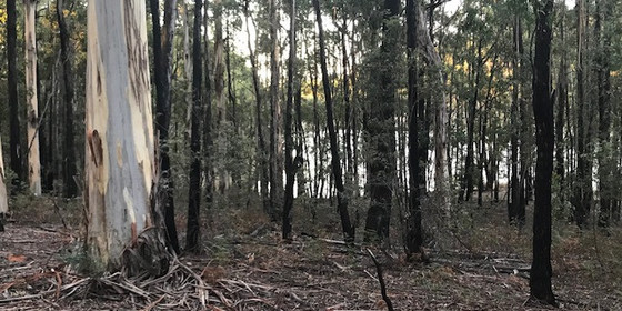
Enjoy a pleasant stroll, in the buff, during the ChillOut Festival weekend at Daylesford.
GRADE | LENGTH | TYPE: Easy, approximately 3 km circuit walk.
MEETING TIME | LOCATION: 2.30pm at Bolton's Takeaway, 31A East St, Daylesford. There is plenty of parking on the vacant grassy block on the SE corner of East St and Mink St. This shop is 1.2 km east of Vincent St (Daylesford's main street). If you would like a lift from Daylesford, send an email or post a comment on Meetup and we will try to arrange a ride for you.
MAP REFERENCE: Melway map X909 grid C9 | Google map goo.gl/maps/ETcZnnjGD1R2.
DISTANCE | TIME FROM GPO: 1 hour 25 minutes (114 km).
COST: Free for Nomads members, $7 for non-members. However if you are a non-member and have paid your $10 for the Morning Chillout walk, you can come along for free. You need to Get Tickets here though.
FOOD: You may wish to bring about 600ml of water. However as the walk is relatively short you may just wish to have a drink before we depart, and have another when we return for afternoon tea. Food is not required but you can take a snack if you like.
APPAREL | FOOTWEAR: Sunscreen, hat, dark glasses, repellent (maybe). Wear comfortable walking shoes/boots. Hopefully we will be able to strip off at the cars and walk straight into the forest. So shorts may not be required. A small towel to dry off after the swim.
ACTIVITY DESCRIPTION: This event is for naturists. Enjoy a pleasant nude stroll through the tall trees and along the picturesque creeks of the Wombat State Forest near Daylesford. A good chance for a chat, or just enjoy the pleasure of being in the forest, nude. The country is undulating and not steep. The tracks are gravel or grass. The walk should take about an hour and a half, followed by afternoon tea (snacks, fruit, drinks in the forest). At about 4.30pm we head for our swimming place and can swim until about 5.30 to 6pm before some of us will need to return to Daylesford for the Saturday night activities.
The swimming place is about 8 km (12 minutes) from Daylesford. People can leave from the swimming place whenever they need to return to Daylesford.
FURTHER INFORMATION:
This walk, along with the Nomads ChillOut Morning Bushwalk at 10:15am on Saturday 9th March and the Nomads Daylesford to Sailors Falls Circuit Walk on Monday 11th March, forms part of the ChillOut Festival Weekend, where you can camp at the Jubilee Lake Holiday Park and participate in some of the ChillOut Festival activities, including the Pride Parade and Carnival on Sunday 10th March.
LEADER | BOOKING: Russell W. | by Thursday 7th March. Email the Leader if you have any questions. Members can access leader contact details under Members->Leader Contacts when logged in to the website.
Mar
09
2019
Past Event
Chillout Saturday Morning Community Bushwalk
Mineral Springs Reserve Road
10:15 – 12:30
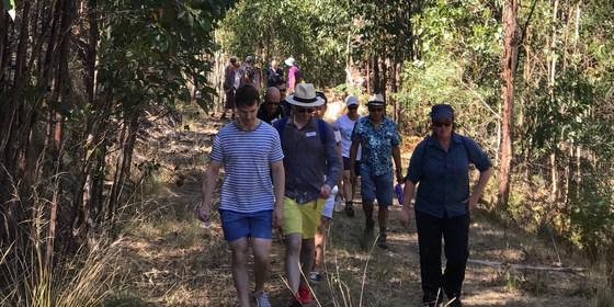
Join us for a walk along the creeks and through the bush of Hepburn Springs, and make new friends along the way.
GRADE | LENGTH | TYPE: Easy to medium, approximately 4.5 km, circuit walk, with a couple of short steep sections.
MEETING TIME | LOCATION: 10:15am at Mineral Springs Reserve Rd, Hepburn Springs - in the carpark at the end of the road, (8 minutes from Daylesford). This road goes past the bathhouse and spa complex.
COST: $5 for Nomads members | $10 for visitors - includes afternoon tea with drinks, fruit and snacks.
FOOD: refreshments - drinks, fruit & snacks (included in the fee), will be provided at the halfway point.
APPAREL | FOOTWEAR: Comfortable walking boots/shoes and dress according to the weather forecast.
ACTIVITY DESCRIPTION: Join The Nomads for the annual morning walk for the Chillout Festival. Taste the strange water from a Mineral Spring and visit Jackson's Lookout Tower high above Hepburn. The walk is approx 4.5 km long and has a couple of short steep sections. We will stop for refreshments at the half way point. Bring water, hat, apply sunscreen, wear sensible shoes.
FURTHER INFORMATION:
This walk, along with the Nomads Pants Off, Mixed Nude Bushwalk and Swim at 2:30pm on Saturday 9th March and the Nomads Daylesford to Sailors Falls Circuit Walk on Monday 11th March, forms part of the ChillOut Festival Weekend, where you can camp at the Jubilee Lake Holiday Park and participate in some of the ChillOut Festival activities, including the Pride Parade and Carnival on Sunday 10th March.
Carnival ticket prices: Pre-sales online: $30 full, $20 concession, $15 under 21 | Gate sales: $35 full, $25 concession, $15 under 21 | Under 12 free.
LEADER | BOOKING: Russell W. | by Thursday 7th March. Email the Leader if you have any questions. Members can access leader contact details under Members->Leader Contacts when logged in to the website.

Mar
08
2019
Past Event
Labour Day Long Weekend – ChillOut Camping & Walks
Jubilee Lake Holiday Park & Cafe
08 Mar 2019 18:00 – 11 Mar 2019 15:00
We’ll use the Jubilee Lake Holiday Park as our base for doing some walks in the Daylesford region whilst also participating in the ChillOut Festival. This park is a little out of the centre of Daylesford, but much nicer and less crowded than the caravan park beside the ChillOut Carnival site.
GRADE | LENGTH | TYPE: Varying from easy to medium | walks, social events and camping - during the ChillOut Festival.
MEETING TIME | LOCATION: 6-10pm on Friday 8th March at the Jubilee Lake Holiday Park, Daylesford.
MAP REFERENCE: Melway map X909 grid C9 | Google map goo.gl/maps/cXKMzKvqni22.
DISTANCE | TIME FROM GPO: Via Western Fwy 118 km, 1 hour 30 minutes | via Calder Fwy 117 km, 1 hour 35 minutes.
ACCOMMODATION: The Nomads “base camp” will be a cluster of unpowered camp sites. Although each site can only have one car parked beside the tents, it can include a number of tents (and a number of people). Additional cars can be parked in the car park, which is fairly close by. We have booked and paid deposits for three sites with the understanding that we can make some adjustments to the booking a week prior to ChillOut, but it would be helpful if you could get a ticket ASAP if you are planning to attend. Because this is a high season weekend, we needed to book each site for a minimum of three nights. Accommodation options at the park other than camping are now booked out.
COST: The Nomads have booked the sites - you don't need to book individually! The base cost of each unpowered campsite is $30 per night, which covers two adults plus one car on the site. Up to four additional adults can be added to each site at a cost of $10 each. We will work out the exact cost per participant by dividing the total cost ($30 for a site and two adults per night plus $10 per extra adult per night) equally among the total number of attendees. The leader will collect each participant's accommodation contribution upon arrival at the park.
FOOD: there are BBQ facilities and a cafe at the holiday park. Alternatively, you can bring your own food for the weekend or dine in Daylesford.
ACTIVITY DESCRIPTION:
There are many events you can attend as part of ChillOut Festival, which is regional Australia’s largest LGBTQI festival, and the Nomads have also organised a number of walks to coincide with it. The Jubilee Lake Holiday Park is a little out of the centre of Daylesford, but much nicer and less crowded than the caravan park beside the ChillOut Carnival site, thus making a great base for your ChillOut long weekend.
Some activities to consider attending include:
Saturday 10:15am: The Nomads ChillOut Community Saturday Morning Walk
Saturday 2:30pm: The Nomads Pants Off, Mixed Nude Bushwalk and Swim, including afternoon tea
Saturday evening: the famous ChillOut Bush Dance + many performance events
Sunday 10am: ChillOut Festival Pride Parade (free)
Sunday 11am: ChillOut Festival Carnival (see prices below)
Monday 10am: The Nomads Daylesford to Sailors Falls Circuit Walk.
Note for non-members: the ChillOut weekend consists of a number of events. If you take out a 1 month temporary membership (cost $8) prior to booking any events, you don't need to pay the $7 visitor fees to any of these events. Once you have taken out your membership, select Get Tickets to get your member ticket on each event that you wish to attend.
FURTHER INFORMATION:
Carnival ticket prices: Pre-sales online: $30 full, $20 concession, $15 under 21
Gate sales: $35 full, $25 concession, $15 under 21 | Under 12 free.
LEADER | BOOKING: Alan D. | by Thursday 28th February or ASAP. Email the Leader if you have any questions. Members can access leader contact details under Members->Leader Contacts when logged in to the website.

Mar
05
2019
Past Event
Monthly Social Night - March
Mountain View Hotel
19:30 – 21:30
Our regular monthly social night - this month at the Mountain View Hotel.
MEETING TIME | LOCATION: 7:30pm | Mountain View Hotel, 68-70 Bridge Rd, Richmond.
PUBLIC TRANSPORT: Tram #48 (via Collins St) or #75 (via Flinders St) to stop 15.
ACTIVITY DESCRIPTION:
Join us for our monthly social evening where members can enjoy a meal, talk about upcoming events, compare notes on past activities and float ideas on events they would like to see run.
LEADER | BOOKING: Alan D. | by Monday 4th March. Email the Leader if you have any questions. Members can access leader contact details under Members->Leader Contacts when logged in to the website.
Mar
03
2019
Past Event
Cancelled - to be rescheduled - Steiglitz Historic Park Walk
Steiglitz Court House
10:30 – 16:00
CANCELLED at 2pm Friday 1 March:
Due to the Bureau of Meteorology forecast for 37deg C temperatures for the Steiglitz / Bacchus Marsh area for Sunday afternoon, together with high humidity from forecast thunderstorms, this walk has been cancelled and will be re-scheduled later in the year. In making this decision I also considered: that Sunday’s 37degC follows three preceding days of 37degC+ heat, making the bush very dry; Vic Emergency Services on 774 this morning put out an alert for the possibility of lightening initiated fires from thunder storms on Sunday, as a cold front passes over Victoria; exercise, such as bushwalking in high temperature and humidity is more stressful on the body than just dry heat; and, the resilience of the walkers wishing to attend.
I trust this is not too great an inconvenience for you,
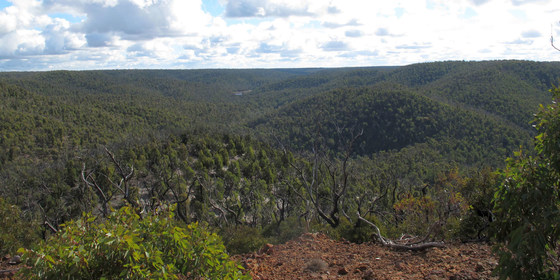
Step back in time to explore the remains of gold mining, including an interesting “ghost town”, nestled among stringybark and grass tree woodlands.
GRADE | LENGTH | TYPE: Moderate to medium circuit walk of about 8.5 km, estimated 4 hours.
MEETING TIME | LOCATION: 10:30am at the Steiglitz Courthouse Car Park, which is on the Geelong-Steiglitz-Meredith Road (C142).
MAP REFERENCE: Melway map 419 grid A1 or X911 grid D4 | Google map goo.gl/maps/SLUbdRhtpFC2.
DISTANCE | TIME FROM GPO: Approximately 95 km from the Melbourne GPO, Steiglitz is north of Geelong and south of Ballan, allow about 1 hour 30 minutes from Melbourne. Drivers should look at a map before they leave, as some local roads are not signposted (e.g. exiting Lara) and some roads may not be on your car GPS or phone. The easiest is along the Princes Hwy / Freeway, continue on the new Geelong Bypass, take the exit after Bacchus Marsh (possibly signed Lovely Banks or Ballan or Meredith) and follow the Lovely Banks Road (north west) [do not take the Anakie Road from Lovely Banks] until you meet the Geelong-Meredith Road C142, and follow it to Stieglitz.
FOOD: There is no food or drink shop at Steiglitz, so bring your lunch, snacks and at least 1 litre of water as it could be a very hot day.
APPAREL | FOOTWEAR: Dress for the weather forecast, and carry rain/wind jacket and beany or sun hat and sunscreen as appropriate. Walk in boots or walking shoes that are suited to poorly made and potentially wet tracks.
ACTIVITY DESCRIPTION:
This 8.5 km circuit walk in the southern part of the Steiglitz Historic Park was originally planned for 17th June 2018, but was cancelled due to extremely wet and windy conditions. The walk is through more varied country than the 9th July 2016 circuit walk along the Burchell Trail in the north of the park. It is also shorter in recognition of the possible high temperatures.
The walk starts from the Courthouse car park and follows tracks S-W towards the Sutherland Creek then swings north to The Crossing Picnic Area (probable lunch stop). We will then head east along the Burchell Trail to The Pines car park and New Chum Mine, and return to the Courthouse via Hay Track for a wander through the old village.
Gold was discovered in the Brisbane Ranges in 1860, and by the 1890s Steiglitz became established adjacent to the Sutherland Creek. It had a population of 2000 plus, with its busy streets including dozens of buildings - houses, banks, several schools, a public library and a courthouse. It is now the home of only a few residents, and an interesting set of name plates marking former buildings. After the walk, some may wish to stay and wander around the historic remains of the town.
FURTHER INFORMATION: Parks Victoria Map & Park Note: parkweb.vic.gov.au/__data/assets/pdf_file/0019/315802/Steiglitz-Historic-Park-Visitor-Guide.pdf
LEADER | BOOKING: Ian G. | by Thursday 28th February. Email the Leader if you have any questions. Members can access leader contact details under Members->Leader Contacts when logged in to the website.
Mar
03
2019
Past Event
Cancelled (Weather too hot!) - Mixed Naturist Bushwalk, The Pinnacle, Werribee River & Gorge
136 Main St
10:00 – 16:00
Unfortunately we've had to cancel our naturist walk planned for Sunday 3rd March. The temperature for Sunday in the Bacchus Marsh area is forecast to reach 37C! As well there is a moderately strong hot northerly wind. Put these together together with the steep climbs needed to reach the remote area of the park we had planned to go to for our views and swim, could have resulted in quite a few of the participants suffering from heat stress. (Generally the limit is 34C in steep hilly country.) A cooler day would be much more pleasant for this walk.
We did contemplate shifting the the walk to an easier route further upstream on the Werribee River at Ballan, but unfortunately the leader now has a head cold, has lost his voice and can't give instructions.
So unfortunately we'll have to leave these walks for another day. Very sorry about that. For those who have paid for their ticket we can arrange a refund.
_______________________________________________________________
There are more naturist events coming up very soon.
Sat 9 Mar Daylesford - Pants off walk and swim.
Sat 16 Mar - World Naked Bike Ride.
Sat 30 & Sun 31 Mar - Castlemaine Diggings Heritage Park, & Chewton Overnight to Sunday morning.
______________________________________________________________
Hope to see you on some of these.
Russell
______________________
______________________
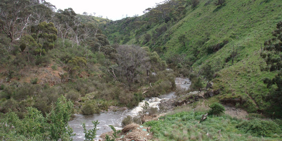
A challenging walk for naturists into the beautiful Werribee River gorge.
GRADE | LENGTH | TYPE: Medium to hard, approximately 8 km circuit walk. The terrain is sometimes undulating, but at other times quite steep. Good footwear is recommended as some of the ground is rather rocky. We also have a fairly large descent into the Werribee River gorge, which means we will have to climb back out again on the way home. The Pinnacle has a narrow track on a high ridge providing great views into the gorge.
MEETING TIME | LOCATION: Meet at 10am for coffee and registration at the Jolly Miller Cafe, 136 Main St, Bacchus Marsh, then travel in a car convoy to the junction of Ironbark Rd and Ingliston Rd on the edge of the Werribee Gorge State Park (11 km, 13 minutes) west of Bacchus Marsh. We will leave the cafe at approximately 10:30am.
MAP REFERENCE: Melway map 333 grid J7 | Google map goo.gl/maps/z2UKHwWav6u.
TIME FROM GPO: 48 minutes, 56 km via the Western Fwy.
PUBLIC TRANSPORT: Catch the 8:16am V/Line train towards Ararat. Get off at Bacchus Marsh Railway Station at 9:01am. From there you can walk 1.7 km (21 minutes) to the cafe, or catch the Route 435 bus into Bacchus Marsh township (it takes 3 minutes). From the bus stop it is a 3 minute walk to the cafe. You should arrive at 9:16 am, just in time for breakfast.
FOOD: Carry lunch, snacks and water for the walk.
APPAREL | FOOTWEAR: Sunscreen, hat, dark glasses, comfortable footwear. Shorts etc. will be needed for the first and the last parts of the walk. Small towel to dry off after swimming.
ACTIVITY DESCRIPTION:
This event is for naturists. Enjoy a nude walk through a remote section of the Werribee Gorge State Park. At first we travel through an Ironbark eucalypt forest before reaching more open country as we descend towards the Werribee River. For the keen we can climb the Pinnacle, a ridge of rock sitting high above the surrounds and providing great views. Should we get too hot there are many waterholes in the Werribee River we can use to cool off.
Afternoon Tea/Drinks: After the walk we will return to Bacchus Marsh, and if desired we can have a beer, cool drink or coffee etc. at the Flanagans Border Inn, 139 Main St, Bacchus Marsh.
LEADER | BOOKING: Russell W. | by Thursday 28th February. Email the Leader if you have any questions. Members can access leader contact details under Members->Leader Contacts when logged in to the website.
Feb
21
2019
Past Event
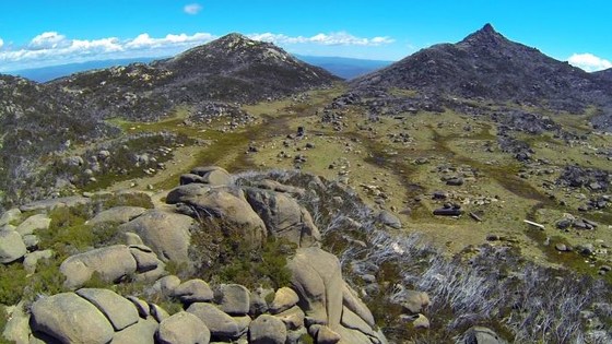
Mt Buffalo Weekend Walking - accommodation at Porepunkah, 21 - 24 February 2019
Mount Buffalo National Park
21 Feb 2019 15:00 – 24 Feb 2019 15:00
Booking full and now closed - contact the Leader if you wish to join the wait-list.
Booking and full payment by Friday 22nd November is essential to participate in this February 2019 social weekend of Nomads walks and exclusive-use accommodation. Mt Buffalo National Park offers spectacular scenery, moderately challenging walks through varying terrain, and rich diversity of flora and fauna, as well as unique geological formations. This popular Nomads weekend social event and walks on Mt Buffalo in Victoria's North-East is now in its fourth year, and David R. will again lead the walks. Bookings are limited to 30, and last year it was over-subscribed, first in - first served!!
GRADE | LENGTH | TYPE: Each day we will drive from our group accomodation in Porepunkah to Mt Buffalo, enjoy the walk, and return in the late afternoon.
(Optional) Friday 22nd Feb walk: Hard; approx 6-8 hrs; Point to point walk
Saturday 23rd Feb walk: Medium-Hard; approx 5-6 hrs; Circuit walk. Evening includes a BBQ communal dinner at our accomodation.
Sunday 24th Feb walk: Easy; approx 2 hrs; After departing Restaway, a Circuit walk ending with lunch at Lake Catani and opportuntiy for a swim. This enables a drive back to Melbourne after lunch or afternoon on Sunday.
MEETING TIME | LOCATION: Arrival time is from 3pm onwards on Friday 22nd Feb 2019 at Restaway Holiday Units, 6852 Great Alpine Road, Porepunkah. For those taking the option of staying Thursday 21st Feb and joining the Friday walk, arrival time at Restaway is from 3pm onwards on Thursday 21st Feb.
Pre-walk briefings and car pooling arrangements to Mt Buffalo will be held at Restaway prior to leaving for each day's walk.
MAP REFERENCE: Meeting point at Restaway Holiday Units: Melway map X922 grid F9 | Google map www.google.com.au/maps/place/Porepunkah+VIC+3740.
DISTANCE | TIME FROM GPO: 320km, approximately 3 hours 30 minutes driving time, via Hume Hwy, Snow Road, Myrtleford to Porepunkah. Public transport possible, but Sunday options are limited.
TRANSPORT: Car sharing preferred.
FOOD: Bring your own breakfasts, lunches, drinks and snacks. During the walks carry your own lunch, snacks and at least 1 litre of water. Only limited food can be purchased at nearby Porepunkah, so bring all your food needs with you.
Friday (and optional Thursday) night, bring your dinner (bbq available) or eat out at the local hotel. Booking and payment includes Nomads famous communal BBQ dinner (incl vegetarian option) on Saturday night 23rd February, BYO drinks. The Organiser may ask you to contribute a salad to this dinner.
APPAREL | FOOTWEAR: Comfortable walking boots, walking poles (if needed), sun hat / wool beany and rain/wind proof jacket. You need to check the Met Bureau weather forcast for Mt Buffalo before you leave Melbourne, so you bring appropriate clothing for hot weather / cold change. Be aware, on Mt Buffao cold winds and rain are likely, even in February.
ACTIVITY DESCRIPTION:
The weekend will follow previous years' sucessful model. The social and walking weekend is based on accomodation at Restaway Holiday Units in Porepunkah (we will make a pre-paid block booking for Nomads exclusive use) for the nights of Friday 22nd and Saturday 23rd February 2019. There will be a one-day walk on Mt Buffalo on the Saturday, the communal BBQ on Saturday evening, and a shorter half-day walk on Mt Buffalo on the Sunday. Following Sunday's walk we will lunch at Lake Catani, with the opportunity for a swim (bring towel) before you leave. This schedule enables people to drive up after work on Friday and return Sunday afternoon or evening.
In addition, for those who wish to arrive a day earlier on Thursday 21st February, the Nomads will book your acccomodation for Thursday night at Restaway too, and there will be a one-day walk (rated hard) on Friday 22nd February. Some people might want to stay at Restaway for Sunday evening or longer. Please contact the event Leader (below) for details.
If fully booked, (as it was last year), we will be the only group staying at Restaway and will have exclusive use of the swimming pool, large garden and BBQ area. Each holiday unit has a small kitchen, living room, bathroom and 2 bedrooms - one bedroom has a queen bed, the other has 2 single beds (some have bunks, but to keep walk numbers at a manageable level of 30, the top bunk will generally not be used).
It is a big big task organising this weekend, so the roles are being split this year. David is organising and leading the walks, and Ian Gould organising the accommodation and communal Saturday dinner. Bookings can only be made through the Nomads web site.
To join this weekend you need to book and pay by Friday 22nd November; this enables the Nomads to secure the booking. We understand that commitment now for a February 2019 event does not suit some people - if you are one of these, we expect you will understand that when the Nomads uses commercial facilities we have to conform to usual business booking requirements.
Please note:
(i) This is a popular event; last year the event was fully booked.
(ii) A booking must include full payment for accomodation.
(iii) Maximum walking group size is 30, limited by accommodation, participant safety and ensuring a quality environmental experience.
(iv) The event is based on a social weekend at Restaway and walks on Mt Buffalo. Please contact the Leader (email below) if you wish to discuss staying elsewhere.
This event is generally not open to Visitors. Please contact the Leader (below) if you are a Visitor and would like to attend.
Booking instructions:
(a) Firstly, choose if you wish to arrive Friday 22nd Feb or Thursday 21st Feb 2019.
(b) Secondly choose if you want 'Shared room' accomodation, in which you will share the room with one other person (separate beds, or, share a queen bed with your partner), OR, want 'Single room' accomodation, which gives you a room for your use only. The Ticket includes the cost of accommodation, Saturday night's BBQ, and participation in the walks.
(c) Buy the Ticket you want, noting: if you and your partner wish to share a booking, you will need to buy two 'Shared room' tickets (see(d) below); please indicate if you prefer vegetarian or non-vegetarian communal BBQ; and, if you are wanting to 'hitch a ride' with a Nomad driving up.
(d) If buying Shared accomodation and you wish to share with a particular person, it is necessary to Email the Leader using the link below to advise him of the name of the person you will be sharing with, and preferred room sharing arrangements. i.e (i) are you wanting to share a Queen bed with your partner (who needs to buy a Ticket too), OR (ii) have a preference to share a twin room with a particlar person. If you buy Shared accomodation and do not send the Leader an email, he will allocate you with another person in a shared room.
FURTHER INFORMATION: https://parkweb.vic.gov.au/explore/parks/mount-buffalo-national-park and https://www.restawayholidayunits.com.au/
LEADER | BOOKING: Ian Gould. | by Friday 22nd November 2018. Email the Leader if you have any questions and advise on Shared acommodation. If you are a Visitor, contact the Leader as this event is not generally open to Visitors. Members can access leader contact details under Members->Leader Contacts when logged in to the website.
Feb
10
2019
Past Event
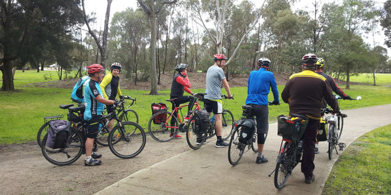
Midsumma Cycling & Punt - Fed Square to Williamstown
ACMI Cafe & Bar
10:30 – 16:00
This easy ride will take us from Federation Square along Southbank, through majestic mansions and gardens in South Melbourne and follow the Bay to Westgate Park with its intriguing Pink Salt Lake. After a short punt ride to Spotswood (cost $5) we'll ride along the coast for lunch at Al Porto Vecchio on the stately Williamstown waterfront.
GRADE | LENGTH | TYPE: Easy 15 to 30 km cycling circuit. (15 km to the lunch point, from where you can return by train, or cycle back to Federation Square via an alternative route).
MEETING TIME | LOCATION: 10:30am departure from ACMI Cafe and Bar, Federation Square. Arrive a bit earlier for a coffee and chat beforehand. Bikes can be parked on Birrarung Marr (on the river side, opposite the Federation Square car park) or beside Transport Public Bar on Swanston St, opposite Flinders Street Station).
MAP REFERENCE: Melway map 1B grid P10 | Google map goo.gl/maps/PLQZM16sWG92.
APPAREL | FOOTWEAR | FOOD: Bike, helmet and spare tube. Dress for the forecast weather conditions. Don't forget sunscreen, drinking water and waterproof gear if the weather forecast indicates any chance of rain. Lunch will be purchased from a pub in Williamstown.
COST: $5 for the punt ride plus cost of your lunch selection from the restaurant in Williamstown.
ACTIVITY DESCRIPTION:
We'll meet at the ACMI Cafe on Federation Square for a leisurely coffee while waiting for everybody to arrive. From there, we'll walk to the nearby bike racks on Birrarung Marr (beside the Yarra) and ride along the Southbank Promenade, then via cycling tracks through South Melbourne to the Bayside Trail in Port Melbourne, admiring some of the stately Victorian era architecture along the way. The trail will take us past Station Pier and through Garden City to Westgate Park, where one of the attractions will be the Pink Salt Lake - which we can expect to be bright pink, a natural phenomenon caused by the mix of high temperatures, sunlight, natural salt levels and low rainfall in summer. (Disclaimer: the lake only turns pink after periods of high heat and low rainfall, so the pink colour isn't guaranteed). From beside Westgate Park we'll take a short punt ride across the Yarra to Spotswood, then cycle along the coast to Williamstown. Lunch will be at Al Porto Vecchio, 175 Nelson Place, overlooking the beautiful Williamstown waterfront.
After lunch, your return could be via train from Williamstown, but most will cycle back via the coastal cycling trail. This time we'll continue past the punt stop (though you could return by punt if that's more convenient for you), under the Westgate Bridge, beside Footscray Rd and through Docklands back to Flinders Street Station. There are several train exit options along the way as well as intersections with several major cycling routes (Maribyrnong River, Moonee Ponds Creek, Capital City Trail...) if any of those are convenient ways for you to return home.
LEADER | BOOKING: Alan D. | by Friday 8th February. Email the Leader if you have any questions. Members can access leader contact details under Members->Leader Contacts when logged in to the website.
Feb
10
2019
Past Event
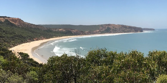
Mixed Nude Beach Day - Point Addis / Southside near Torquay
1200 Great Ocean Rd
10:30 – 16:00
Enjoy a day with some naturist friends on one of Victoria’s most beautiful surf beaches.
GRADE | LENGTH | TYPE: Easy, approximately 1.5 km walk from the car park to our lunch spot on the beach. There are quite a few steps from the road down to the beach, but you can always take your time.
MEETING TIME | LOCATION: 10:30am at the Great Ocean Rd Chocolaterie & Ice Creamery, 1200 Great Ocean Rd, Bellbrae. The cafe is not that far from Anglesea (6 km on the Melbourne side). We plan to drive off from the cafe at about 10:50am. The cafe sells filled rolls if you need something for lunch. They also have a good breakfast menu. However it you'd like to eat there, please arrive at about 10am so you have time to eat your food before we prepare to leave at 10:45am.
Beach Parking: We plan to park in or near the Pt Addis Rd car park, which is about 200 metres past no. 282 Point Addis Rd, Bells Beach. The car park is quite small and by the time we arrive it will probably be full. In that case you will need to park along the roadside, taking note of the parking signs. We will then wait for everybody at the top of the stairs to walk down to the beach together.
Note: If you miss us at the cafe, go straight to the car park in Pt Addis Rd (which is 200 metres past no. 282 Point Addis Rd, Bells Beach). Park your car and then walk down the walkway to the beach. When you reach the bottom of the stairs, turn to the left. Walk for about 1.2 km (20 minutes) and you should find our camp. We plan to stop about 600m before the headland/point.
MAP REFERENCE: Melway orange Key Map 15 grid A21 and Melway touring map 911 grid D9. | Google map goo.gl/maps/GE82eaSi9Lo.
DISTANCE | TIME FROM GPO: 1 hour 20 minutes (109 km).
COST: The Nomads Outdoors Group has kindly offered to run their Beach Days for free for Visitors and Members. However we would still like you to obtain a ticket, which means you will be an official member of the Beach Event and will be covered by insurance.
FOOD: Bring lunch, snacks, water, drinks.
APPAREL | FOOTWEAR: Sunscreen, hat, dark glasses, repellent, towel, footwear if sand is hot. Shorts etc. required to get from the car park to the appropriate section of the beach. Beach umbrella or shade equipment would be useful.
ACTIVITY DESCRIPTION:
This event is for naturists. Enjoy a pleasant nude beach day, with a leisurely lunch and swim. Optional activities include, body surfing in a moderate surf and a beach walk to one of the rocky headlands nearby. If the tide is out we can walk around the headland to the next beach (Southside) which is also nude. The cliffs along the beach are quite spectacular. We can leave the beach whenever we feel like it. The time will depend very much on the weather.
After the Beach Day: For those who would like to, we can go to Torquay for a cool drink or coffee and snacks. Meet at the Torquay Hotel, 36 Bell St, Torquay.
LEADER | BOOKING: Russell W. | Please book as soon as you can by obtaining your free ticket from the "Get Tickets" button on this page. If you have any questions you can email the leader Russell on russjw2005@yahoo.com.au
Feb
09
2019
Past Event
Mixed Nude Beach Day - Point Addis near Torquay. Postponed to Sun 10th Feb.
1200 Great Ocean Rd
10:30 – 16:00
IMPORTANT ANNOUNCEMENT
The Sat 9th Pt Addis nude beach day is postponed by one day to Sun 10th Feb.
Unfortunately the weather for Sat is NOT good for a beach day - rain at 9am, showers & only 16C at midday, with a strong WSW wind blowing along the beach. You will need your heavyweight poncho!
Sun 10th is supposed to be 25C and mostly sunny, with a light WNW breeze, sounds good.
Unfortunately quite a few of you will now not be able to attend, much to our disappointment.
A new event has now been be posted on Meetup and The Nomads for your RSVP.
We hope many of you will still be able to join us for a pleasant warm & sunny day on the beach!
_______________________________________________________________________________________
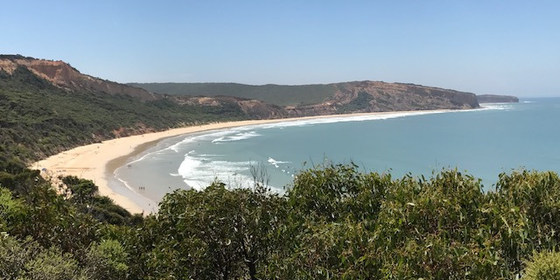
Enjoy a day with some naturist friends on one of Victoria’s most beautiful surf beaches.
GRADE | LENGTH | TYPE: Easy, approximately 1.5 km walk from the car park to our lunch spot on the beach. There are quite a few steps from the road down to the beach, but you can always take your time.
MEETING TIME | LOCATION: 10:30am at the Great Ocean Rd Chocolaterie & Ice Creamery, 1200 Great Ocean Rd, Bellbrae. The cafe is not that far from Anglesea (6 km on the Melbourne side). We plan to drive off from the cafe at about 10:50am. The cafe sells filled rolls if you need something for lunch. They also have a good breakfast menu. However it you'd like to eat there, please arrive at about 10am so you have time to eat your food before we prepare to leave at 10:45am.
Beach Parking: We plan to park in or near the Pt Addis Rd car park, which is about 200 metres past no. 282 Point Addis Rd, Bells Beach. The car park is quite small and by the time we arrive it will probably be full. In that case you will need to park along the roadside, taking note of the parking signs. We will then wait for everybody at the top of the stairs to walk down to the beach together.
Note: If you miss us at the cafe, go straight to the car park in Pt Addis Rd (which is 200 metres past no. 282 Point Addis Rd, Bells Beach). Park your car and then walk down the walkway to the beach. When you reach the bottom of the stairs, turn to the left. Walk for about 1.2 km (20 minutes) and you should find our camp. We plan to stop about 600m before the headland/point.
MAP REFERENCE: Melway orange Key Map 15 grid A21 and Melway touring map 911 grid D9. | Google map goo.gl/maps/GE82eaSi9Lo.
DISTANCE | TIME FROM GPO: 1 hour 20 minutes (109 km).
COST: The Nomads Outdoors Group has kindly offered to run their Beach Days for free for Visitors and Members. However we would still like you to obtain a ticket, which means you will be an official member of the Beach Event and will be covered by insurance.
FOOD: Bring lunch, snacks, water, drinks.
APPAREL | FOOTWEAR: Sunscreen, hat, dark glasses, repellent, towel, footwear if sand is hot. Shorts etc. required to get from the car park to the appropriate section of the beach. Beach umbrella or shade equipment would be useful.
ACTIVITY DESCRIPTION:
This event is for naturists. Enjoy a pleasant nude beach day, with a leisurely lunch and swim. Optional activities include, body surfing in a moderate surf and a beach walk to one of the rocky headlands nearby. If the tide is out we can walk around the headland to the next beach (Southside) which is also nude. The cliffs along the beach are quite spectacular. We can leave the beach whenever we feel like it. The time will depend very much on the weather.
After the Beach Day: For those who would like to, we can go to Torquay for a cool drink or coffee and snacks. Meet at the Torquay Hotel, 36 Bell St, Torquay.
LEADER | BOOKING: Russell W. | by Wednesday 6th February. Email the Leader if you have any questions. Members can access leader contact details under Members->Leader Contacts when logged in to the website.
Feb
05
2019
Past Event
Monthly Social Night - February
642 Bridge Rd
19:30 – 21:30
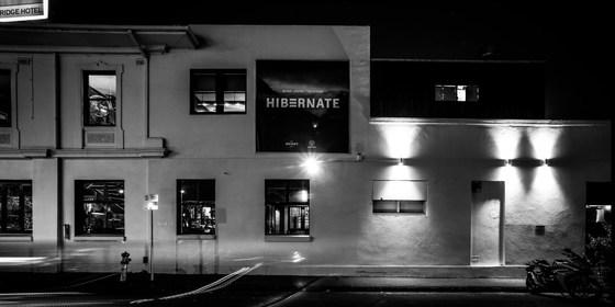
Our regular monthly social night - this time at the Bridge Hotel in Richmond.
MEETING TIME | LOCATION: 7:30pm | The Bridge Hotel, 642 Bridge Rd, Richmond.
PUBLIC TRANSPORT: Tram #48 (via Collins St) or #75 (via Flinders St) to stop 22.
ACTIVITY DESCRIPTION:
Join us for our monthly social evening where members can enjoy a meal, talk about upcoming events, compare notes on past activities and float ideas on events they would like to see run.
LEADER | BOOKING: Garry O. | by Monday 4th February. Email the Leader if you have any questions. Members can access leader contact details under Members->Leader Contacts when logged in to the website.

Feb
03
2019
Past Event
Midsumma Pride March
Ian Johnson Oval
10:30 – 16:00
Gather your friends together and head along to Fitzroy St, St Kilda to march with The Nomads in the annual Midsumma Pride March. The march begins at 11am, with assembly prior to that on the Ian Johnson Oval, cnr Lakeside Drive and Fitzroy St, St Kilda. See Midsumma Pride March for comprehensive details.
LEADER | BOOKING: Garry O. | by Saturday 2nd February. Email the Leader if you have any questions. Members can access leader contact details under Members->Leader Contacts when logged in to the website.
