The Nomads Outdoors Group Inc.
Powered by
Past events
All events
Past events
Apr
25
2021
Past Event
The NOMADS Salute To Love & Our Parklands - Midsumma Event
Boroondara General Cemetery
10:30 – 16:00
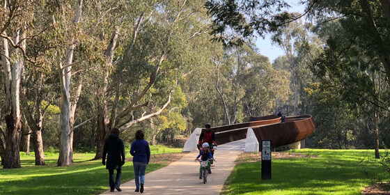
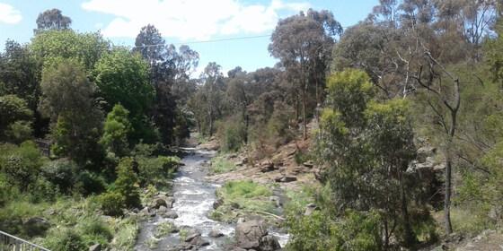
Explore memorials to love in the Boroondara General Cemetery, then traverse a series of connected parklands, finishing at Alphington Railway Station. This is a Midsumma Festival event.
GRADE | LENGTH | TYPE: Easy, approximately 6 km, point-to-point walk.
ACTIVITY DESCRIPTION:
This point-to-point walk starts with a tour of the historic garden style cemetery where we will inspect memorials to love - both gay and straight. The cemetery is noted for its outstanding collection of memorials. Departing the cemetery, the walk will continue through a series of connected parklands to our destination of Alphington Railway Station. The parklands include Victoria Park, Hyde Park, Willsmere-Chandler Park, Kew Billabong, then past golf courses as we cross the Yarra River and enter Napier Waller Reserve followed by Sparks Reserve and finally into Darebin Parklands. We’ll have lunch overlooking the banks of the Yarra River. Travel via public transport is recommended.
Land for the historic 13 hectare Boroondara Cemetery was set aside in 1855 with the first burial taking place in March 1859. The cemetery is laid out in the Victorian garden style with burials allocated by the then practice of religious denomination.
BOOKING: By Thursday 22nd April. To register, click on Get Tickets. Tickets are also available from midsumma.org.au.
COVIDSAFE PUBLIC EVENT REGISTRATION: Nomads Midsumma Walk - SubmissionReceipt-COVIDSafePublicEventRegistrationForm-7384.pdf.
FURTHER INFORMATION: www.kewcemetery.com.au
MEETING TIME | LOCATION: 10:30am at the entrance to Boroondara Cemetery.
MAP REFERENCE: Melway map 45 grid E5 | Google maps goo.gl/maps/vTifVjAfmaFGoBFb7.
DISTANCE | TIME FROM GPO: 8km, approximately 20 minutes to drive, 30 minutes by public transport.
PUBLIC TRANSPORT: Tram #48 - North Balwyn to stop #36 - Parkhill Road. Alternatives are Trams #16 and #109 to the corner of Cotham and Glenferrie Roads then walk along Mary Street (550 metres - 7 minutes).
FOOD: Carry lunch, snacks and at least 1 litre of water, refills plus access to toilets available along the route.
APPAREL | FOOTWEAR: Face mask, hand sanitiser, comfortable walking boots/shoes and dress according to the weather forecast.
LEADER: Garry O. | Email the Leader if you have any questions.
Members can access leader contact details under Members | Leader Contacts when logged in to the website.
HOME BACK TO LIST OF EVENTS MEMBERSHIPS
Apr
24
2021
Past Event
Mixed Naturist Bushwalk near Lancefield v2, optional BBQ & o/night
Lancefield
24 Apr 2021 10:30 – 25 Apr 2021 16:00
THIS IS EVENT WILL BE SIMILAR TO THE EASTER EVENT HELD ON SAT 3RD AND SUN 4TH APRIL.
(This event has just become fully booked with with 22 people booked in. If you would like to be placed on the Waitlist, please send an email to the leader by clicking on 'Russell' )
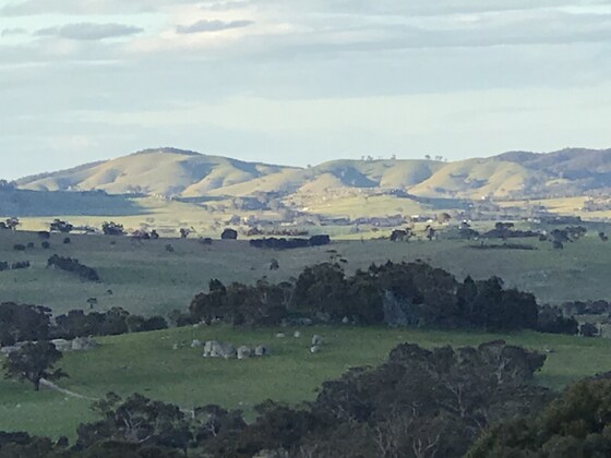
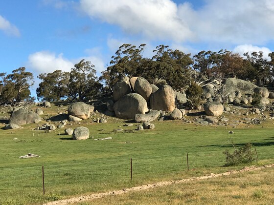
A naturist walk of medium difficulty through two farms in the spectacular granite boulder country north of Lancefield. A picturesque creek, some untouched forest and great views from two of the nearby rocky outcrops that we have not visited before.
GRADE | LENGTH | TYPE: Medium 6 km naturist circuit walk. There is some easy walking through grassy paddocks, a little bit of log hopping along the creek and a few moderate inclines. To get to the views from the rocky outcrops will take a bit more effort, but if you like you can travel around the bottom of the outcrops and we will meet you again as we come down.
ACTIVITY DESCRIPTION:
SATURDAY WALK: This walk is for naturists. We will meet and unload the cars at the overnight farmhouse anytime between 10am and 10:30am. Hot drinks and nibbles will be available until 11am. We will then take some of the cars 3 km to a neighbouring property. From there we plan to get ourselves comfortably unattired and start our walk through the picturesque countryside along the creek and up into the forest with the huge granite boulders. We will then cross into a neighbouring property and ascend two of the rocky outcrops for great views to the north. After our descent we can circle around past an old house ruin to our parked cars. If the weather is warm enough we can have a dip in a farm dam. Following this we can then head back to the overnight farmhouse for drinks and snacks at around 4pm.
OVERNIGHT: Optional evening BBQ, overnight, breakfast and lunch at the farmhouse. After the walk we have been invited back for further nude socialising at the very comfortable farmhouse with its great open fire.
SLEEPING: For those staying overnight, there are two made-up queen size beds. Other people can sleep on the carpeted floor in the library or the lounge room - please BYO sleeping bag, sleeping mat/lilo, pillow etc. There is one spare doona, a few sleeping bags and a couple of spare foam sleeping mats at the property. Or if you like, you can put up your tent on the back lawn. There is also room for campervans etc.
BBQ: BYO meat and drinks. Basic salads and bread will be supplied. A few desserts and other snacks would be appreciated.
TOWELS: Please BYO towels for sitting on and for a shower.
BREAKFAST: Breakfast is supplied, including eggs and bacon, and for Sunday lunch there are always plenty of leftovers from the night before.
OTHER OPTIONS: For those who would like to have a look around the very picturesque scenery at the overnight farm on the Sunday morning, we plan to do a short nude walk of about 1.5 to 2 hours along Mollison Creek, or to the Gorge, or to the host's back paddocks. This wil be followed by lunch to eat up the spare food.
BOOKING: By Wednesday 21st April. To register, click on Get Tickets. One ticket covers all activities you may wish to participate in - walk, BBQ and/or overnight.
RSVP FOR OVERNIGHT ACCOMMODATION: If you wish to stay overnight, you will need to SEND AN EMAIL to Colin, our farmhouse host, on LeaderColinP.thenomadsinc@mail.tidyhq.com to book your accommodation. Please state what accommodation you would like - bed, floor, tent or campervan. Please also include a contact phone number.
Sleeping places in the house are limited to 18.
There is no limit on tents and campervans.
NOMADS COVIDSAFE CHECKLIST: Checklist 210424 Bushwalk near Lancefield, optional BBQ & O/night.
COST: Free for Nomads financial members, $10 for visitors.
MEETING TIME | LOCATION: Any time between 10am and 10:30am at a farmhouse 15 km north of Lancefield. The exact address will be sent to those who have purchased a ticket by 10am on Thursday 22nd April. We plan to drive 3 km to the start of the walk at about 11am.
Tea, coffee and snacks will be provided at the farmhouse. If you'd like egg and bacon sandwiches/rolls and a latte etc beforehand, the best place to get these would be from a cafe in the towns of Romsey or Lancefield.
MAP REFERENCE: Melway map X909/609 grid J7 | Google Map: goo.gl/maps/5tjy71DBz9waYR9a6.
DISTANCE | TIME FROM GPO: 87 km and 1 hour 15 minutes from the GPO. The farm and the town of Lancefield are due north of Tullamarine Airport.
PUBLIC TRANSPORT: Catch the 7:48am Metro train from Southern Cross to Sunbury station arriving at 8:32am. At Sunbury catch the 9am regional bus to Lancefield. From there we will need to arrange a ride to the farm for you. It probably would be easier for you to email the leader, Russell, on LeaderRussellW.thenomadsinc@mail.tidyhq.com to see if he can arrange a lift from your home for you.
FOOD: Carry lunch, snacks and water for the Saturday naturist walk.
APPAREL | FOOTWEAR: Bring face mask, hand sanitiser, sunscreen, hat, sunglasses. Wear comfortable walking shoes/boots. A small towel to dry off after a swim in the farm dam if it's warm enough. We are hoping for a sunny day but It could be getting cool by this time of the year. Bring appropriate clothing to keep youself comfortably warm.
LEADER: Russell W. | Email the Leader if you have any questions.
Members can access leader contact details under Members | Leader Contacts when logged in to the website.
HOME BACK TO LIST OF EVENTS MEMBERSHIPS
Apr
18
2021
Past Event
Merri Creek & Inner Circle Rail Trail Walk
Coburg Lake Reserve
10:45 – 16:00
Enjoy a pleasant day walking along the picturesque Merri Creek on a moderate walk through the inner northern suburbs of Melbourne. The walk includes some hidden gems as well as a good array of birdlife, the result of many years of replanting indigenous vegetation. The often-shady trail hugs the creek intimately, with wetlands, cable suspension bridges, parks and veggie gardens. We then pick up the Inner Circle Rail Trail, with its remnants of the old inner circle rail line which once connected North Fitzroy to Parkville and is now a linear park. Your guide will talk about the history of the rail line and its importance to Melbourne's railway past.
This is intended to be a public transport friendly event where the start and end points will be accessible by train and tram.
GRADE | LENGTH | TYPE: Moderate, approximately 11.5 km point-to-point walk on mostly flat paths.
ACTIVITY DESCRIPTION:
Our walk starts at the very popular Coburg Lake Reserve, where the Merri Creek will be waiting for us. After briefly exploring the lake, we make our way south along the Merri Creek Path where we will closely follow the creek over a number of bridges, parklands, wetlands and reserves. We will stop for lunch beside the Merri Creek to enjoy the views and sounds of the creek.
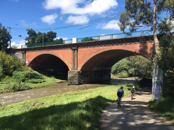
After crossing the old trestle railway bridge, we will then pick up the Inner Circle Rail Trail, a linear reserve remaining from what is left of the abandoned railway line that stopped running in 1981 after a long history of service. The trail now serves as a shared bicycle path connecting the Merri and Moonee Ponds Creeks. We will discuss the history of the line and your leader will point out the locations of the old stations and the existing infrastructure that remains today.
Moving further west our walk concludes at Royal Park Station (next to the Melbourne Zoo), where those who travelled by car will take the train back to the beginning point of the walk.
BOOKING: By Thursday 15th April. To register, click on Get Tickets.
NOMADS COVIDSAFE CHECKLIST: Checklist 210418: Merri Creek & Inner Circle Rail Trail Walk.
FURTHER INFORMATION: Merri Creek Brochure.
MEETING TIME | LOCATION: 10:30am | Lake Grove Carpark, Coburg Lake Reserve, Coburg North.
MAP REFERENCE: Melway map 17 grid H10 | Google map goo.gl/maps/s29AJAqkwh7ejgU87.
DISTANCE | TIME FROM GPO: 9.5 km, approximately 30 minutes to drive, 25-35 minutes by public transport. There is car parking available at the Lake Reserve in Lake Grove free of charge. You will need a Myki card to return back to your car by public transport, either by tram or train.
PUBLIC TRANSPORT:
By Train: Take the Upfield train line from the CBD and get off at Batman Station. Walk east for 4 minutes to the starting point. The conclusion of the walk will be at Royal Park station (same train line) where you can return back to the CBD.
By Tram: Take the Route 19 Tram from Elizabeth Street CBD. Get off at Stop 37 (Gaffney Street/Sydney Road). Walk 2 minutes east to the starting point. The conclusion of the walk will cross the same tram line (Stop 18) where you can return back to the CBD.
FOOD/DRINKS: Carry lunch, snacks and at least 1 litre of water. Also carry sunscreen and a hat, your facemask and hand sanitizer. Bring your Myki card for the return trip by tram or train for those travelling by car back to the starting point.
APPAREL | FOOTWEAR: Comfortable walking boots/shoes and dress according to the weather forecast. Ensure your shoes are waterproof as some of the paths may be wet or muddy if it has rained heavily prior to the event.
LEADER: Jason T. | Email the Leader if you have any questions.
Members can access leader contact details under Members | Leader Contacts when logged in to the website.
HOME BACK TO LIST OF EVENTS MEMBERSHIPS
Apr
14
2021
Past Event
Walk & Mid-week Lunch at Drouin
Southern Cross Station
10:15 – 17:39
Enjoy a train ride to Gippsland and a country pub meal followed by a stroll through a park.
GRADE: Social with a short walk.
ACTIVITY DESCRIPTION:
Travel will be by train (car optional). On arrival at Drouin, it is a 5 minute walk to the Family Hotel, situated on the main street across from the station. There is an outdoor deck which looks out towards Civic Park where we can have lunch. Seating is bench style. If it is too hot or wet, we can move indoors for lunch. After lunch we will go for a walk in Civic Park for up to an hour before catching the train home.
BOOKING: By Sunday 11th April. To register, click on Get Tickets.
NOMADS COVIDSAFE CHECKLIST: Checklist 210414: Walk and mid-week lunch at Drouin.
FURTHER INFORMATION: vline.com.au | metrotrains.com.au | drouinfamilyhotel.com.au.
MEETING TIME | LOCATION: 10:15am at Southern Cross Railway Station for a 10:24am departure, or at stops en route. We will travel in the rear car. Check monitors for the platform number.
MAP REFERENCE:
Southern Cross Station: Melway map 1A grid A6 | Google map goo.gl/maps/9fKccFxNupbMGEBNA.
Drouin Family Hotel: Melway map X928 grid A7 | Google map goo.gl/maps/hJwKHqgEngUYvXz86.
DISTANCE | TIME FROM GPO: Distance to Drouin is 100 km, 93 minutes by train.
PUBLIC TRANSPORT:
Departure: Traralgon train departs Southern Cross at 10:24am (Flinders Street at 10:29am, Caulfield at 10:43am, Clayton at 10:54am, Dandenong at 11:10am, Pakenham at 11:29am) arriving Drouin at 11:57am.
Return: Departure from Drouin at 3:10pm, arriving Southern Cross at 4:44pm with stops at the same stations as the outbound train, except Clayton. The next train departs Drouin at 4:04pm, arriving Southern Cross 5:39pm.
FOOD: Pub food in the Family Hotel bistro. Check their bistro menu/prices (PDF).
APPAREL | FOOTWEAR: Casual. Sunglasses, hat, sunscreen, repellent, face mask and hand sanitiser. Dress for weather forecast.
LEADER: Paul K. | Email the Leader if you have any questions.
Members can access leader contact details under Members | Leader Contacts when logged in to the website.
HOME BACK TO LIST OF EVENTS MEMBERSHIPS
Apr
13
2021
Past Event
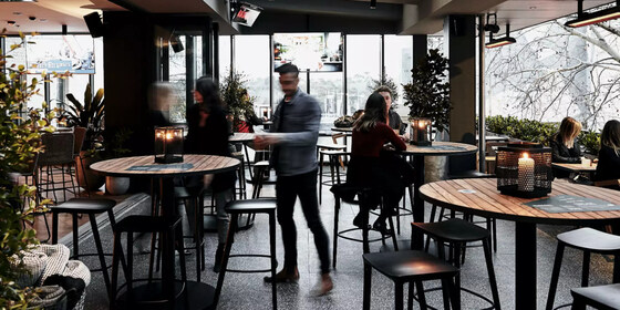
Winter Planning & Social Evening
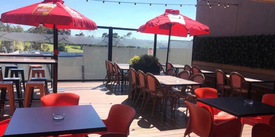
The Duke of Wellington Pub & Rooftop Bar
19:00 – 21:00
Our quarterly planning night, in conjunction with the regular monthly social night - this month at the Duke of Wellington Hotel in the CBD.
GRADE: Social.
ACTIVITY DESCRIPTION:
Do you want to see more of a particular activity, or do you have a particularly favourite area of Victoria you would like to share with others? Do you have an idea for something apart from the regular walks? Come along to the planning meeting, and then stay for our monthly social evening where members talk about upcoming events, share a meal and compare notes on past activities. All members are welcome – you don't have to volunteer for an activity. New members are especially invited to this meeting as an orientation to Nomads activities.
BOOKING: By Monday 12th April. To register, click on Get Tickets.
MEETING TIME | LOCATION: 7pm in the Rooftop Bar of the Duke of Wellington Hotel, 146 Flinders St, Melbourne.
MAP REFERENCE: Melway map 1B grid R9 | Google map g.page/thedukeofwellingtonmelbourne?share.
PUBLIC TRANSPORT: 35, 70 or 75 tram to stop 6 (Flinders/Russell St) or any train to Flinders Street Station.
LEADER: Garry O. | Email the Leader if you have any questions.
Members can access leader contact details under Members | Leader Contacts when logged in to the website.
HOME BACK TO LIST OF EVENTS MEMBERSHIPS
Apr
11
2021
Past Event
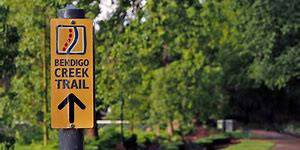
Cancelled - Kangaroo Flat to Bendigo Walk
Kangaroo Flat Railway Station
08:55 – 18:24
An urban walk in Bendigo.
GRADE | LENGTH | TYPE: Moderate, 16 km, point-to-point walk. Mostly flat.
ACTIVITY DESCRIPTION:
Travel will be by train, car optional. We will arrive at Kangaroo Flat at 10:57am then walk from the station to the Bendigo Creek to join the Bendigo Creek Trail. We will walk to Crusoe Reservoir, which we may walk around, then return to Kangaroo Flat and continue on to Bendigo, passing through Gateway Park along the way.
BOOKING: By Thursday 8th April. To register, click on Get Tickets.
NOMADS COVIDSAFE CHECKLIST: Checklist 210411 Kangaroo Flat to Bendigo Walk.
MEETING TIME | LOCATION: 8:55am at Southern Cross Railway Station for a 9:06am departure. This train is the Echuca service.
MAP REFERENCE:
Southern Cross Station: Melway map 1A grid A6 | Google map goo.gl/maps/thDNtAaLvphkZuVp6.
Kangaroo Flat Station: Melway map X921 grid D9 | Google map goo.gl/maps/pm12wkEX6fjDRSfr5.
DISTANCE | TIME FROM GPO: Train: 1 hour 50 minutes | Car: 147 km, 1 hour 40 minutes via Calder Fwy.
PUBLIC TRANSPORT:
Outbound: 9:06am Echuca service to Kangaroo Flat.
Return: Trains to Melbourne depart at 4:26pm and 5:26pm, arriving in Melbourne at 6:24pm and 7:24pm respectively.
Further information: see vline.com.au or ptv.vic.gov.au/journey.
Train Cost: Economy Return: Adult $47.60 | Concession $23.80 or use free annual ticket. All regional train tickets include free suburban travel.
FOOD: Bring lunch, water, and snacks if desired.
APPAREL | FOOTWEAR: Walking boots, hat, sunglasses, sunscreen, repellent, face mask, hand sanitiser and dress for the weather forecast.
LEADER: Paul K. | Email the Leader if you have any questions.
Members can access leader contact details under Members | Leader Contacts when logged in to the website.
HOME BACK TO LIST OF EVENTS MEMBERSHIPS
Apr
10
2021
Past Event
Cycling from Southern Cross, Albert Park region
Southern Cross Station/Collins St
10:30 – 15:30
A gentle, relaxing cycle ride through Southbank, South Melbourne, Middle Park and Albert Park.
GRADE | LENGTH | TYPE: Moderate, approximately 28 km, cycling circuit. This will be a scenic, social ride for those who like to take in the sights and have a chat along the way.
ACTIVITY DESCRIPTION:
Departing from Southern Cross Station we head along Collins St West to join up with the Capital City Trail. We head south on that to cross the Yarra via Webb Bridge, onto the Yarra Edge waterside promenade. We'll stop for a coffee (optional) at Hooks at the Yarra, 50 River Esplanade, Docklands, which has plenty of bike parking and outdoor seating.
Upon departing from the cafe, we continue along the waterfront promenade to the end of the path, which connects with Lorimer Street to head west and eventually join the nature trail under Westgate Bridge, which we follow around to Sandridge Beach. Continuing along the Beaconsfield Parade cycling path we cut inland to the Middle Park Hotel, 102 Canterbury Rd, Middle Park for lunch.
After lunch we'll cycle around Albert Park Lake then cross Queens Rd, pass by the Albert Cricket Ground and follow Commercial Rd briefly to get to Fawkner Park. We cycle all the way through Fawkner Park to connect to the Botanical Gardens via Marne St. We cycle beside the gardens along Anderson St, cross the Yarra via the Morell Bridge and return to Federation Square via the Capital City Trail. From there you can catch a train, or alternatively follow the Capital City Trail in either direction to return homeward via any of the routes linking to that.
BOOKING: By Wednesday 7th April. To register, click on Get Tickets.
NOMADS COVIDSAFE CHECKLIST: Checklist 210410 Cycling from Southern Cross, Albert Park Region.
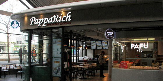
MEETING TIME | LOCATION: 10.15am for a 10:30am departure from Southern Cross Station (upper level), at the cycle parking outside Pappa Rich Cafe, 3 Collins St, Melbourne. This is close to the Collins St tram stop outside Southern Cross Station.
MAP REFERENCE: Melway map 2E grid K6/K7 | Google map goo.gl/maps/sCAivYpvUK2WWGQz9.
PUBLIC TRANSPORT: any train line to Southern Cross Station.
FOOD: we will order lunch at a cafe in Middle Park. Bring a litre of water plus snacks if you wish.
APPAREL | FOOTWEAR: Bring face mask, hand sanitiser, helmet, spare tube and dress according to the weather forecast.
LEADER: Michael C. | Email the Leader if you have any questions.
Members can access leader contact details under Members | Leader Contacts when logged in to the website.
HOME BACK TO LIST OF EVENTS MEMBERSHIPS
Apr
03
2021
Past Event
Mixed Naturist Bushwalk near Lancefield, Optional BBQ & O/night
Lancefield
03 Apr 2021 10:30 – 04 Apr 2021 16:00
We currently have a good group of 21 people booked in for this event, which means we have 3 places left. This includes 4 people coming for Sat only.
(There is a limit of 20 people overnight so that we can all fit comfortably in the house.)
All the bedrooms have now been booked, but there is still carpet space available for sleeping on.
AND the good news, the forecast has predicted Saturday and Sunday at the farm to be Sunny and 31C. Amazing! Sunny days for a naturist event!
We think we may go to the Rocky Outcrops in the morning, and then in the afternoon go for a short walk to the waterhole for a skinny dip and sunbake on the lovely sandy beach.
______________________________________________
A naturist walk of medium difficulty through two farms in the spectacular granite boulder country north of Lancefield. A picturesque creek, some untouched forest and great views from two of the nearby rocky outcrops that we have not visited before.
GRADE | LENGTH | TYPE: Medium 6 km naturist circuit walk. There is some easy walking through grassy paddocks, a little bit of log hopping along the creek and a few moderate inclines. To get to the views from the rocky outcrops will take a bit more effort, but if you like you can travel around the bottom of the outcrops and we will meet you again as we come down.
ACTIVITY DESCRIPTION:
SATURDAY WALK: This walk is for naturists. We will meet and unload the cars at the overnight farmhouse anytime between 10am and 10.30am. Hot drinks and nibbles will be available until 11am. We will then take some of the cars 3 km to a neighbouring property. From there we plan to get ourselves comfortably unattired and start our walk through the picturesque countryside along the creek and up into the forest with the huge granite boulders. We will then cross into a neighbouring property and ascend two of the rocky outcrops for great views to the north. After our descent we can circle around past an old house ruin to our parked cars. If the weather is warm enough we can have a dip in a farm dam. Following this we can then head back to the overnight farmhouse for drinks and snacks at around 4pm.
OVERNIGHT: Optional evening BBQ, overnight, breakfast and lunch at the farmhouse. After the walk we have been invited back for further naturist socialising at the very comfortable farmhouse with its great open fire.
SLEEPING: For those staying overnight, there are two made-up queen size beds. Other people can sleep on the carpeted floor in the library or the lounge room - please BYO sleeping bag, sleeping mat/lilo, pillow etc. There is one spare doona, a few sleeping bags and a couple of spare foam sleeping mats at the property. Or if you like, you can put up your tent on the back lawn. There is also room for campervans etc.
BBQ: BYO meat and drinks. Basic salads and bread will be supplied. A few desserts and other snacks would be appreciated.
TOWELS: Please BYO towels for sitting on and for a shower.
BREAKFAST: Breakfast is supplied, including eggs and bacon, and for Sunday lunch there are always plenty of leftovers from the night before.
OTHER OPTIONS: For those who would like to have a look around the very picturesque scenery at the overnight farm on the Sunday morning, we plan to do a short naturist walk of about 1.5 to 2 hours along Mollison Creek, or to the Gorge, or to the host's back paddocks. This will be followed by lunch to eat up the spare food.
BOOKING: By Wednesday 31st March. To register, click on Get Tickets. One ticket covers all activities you may wish to participate in - walk, BBQ and/or overnight.
RSVP FOR OVERNIGHT ACCOMMODATION: If you wish to stay overnight, you will need to SEND AN EMAIL to Colin, our farmhouse host, on LeaderColinP.thenomadsinc@mail.tidyhq.com to book your accommodation. Please state what accommodation you would like - bed, floor, tent or campervan. Please also include a contact phone number.
Sleeping places in the house are limited to 18.
There is no limit on tents and campervans.
NOMADS COVIDSAFE CHECKLIST: Checklist 210403 Bushwalk near Lancefield, optional BBQ & O/night.
COST: Free for Nomads financial members, $10 for visitors.
MEETING TIME | LOCATION: Any time between 10am and 10.30am at a farmhouse 15 km north of Lancefield. The exact address will be sent to those who have purchased a ticket by 10am on Thursday 1st April. We plan to drive 3 km to the start of the walk at about 11am.
Tea, coffee and snacks will be provided at the farmhouse. If you'd like egg and bacon sandwiches/rolls and a latte etc beforehand, the best place to get these would be from a cafe in the towns of Romsey or Lancefield.
MAP REFERENCE: Melway map X909/609 grid J7 | Google Map: goo.gl/maps/5tjy71DBz9waYR9a6.
DISTANCE | TIME FROM GPO: 87 km and 1 hour 15 minutes from the GPO. The farm and the town of Lancefield are due north of Tullamarine Airport.
PUBLIC TRANSPORT: Catch the 7:48am Metro train from Southern Cross to Sunbury station arriving at 8:32am. At Sunbury catch the 9am regional bus to Lancefield. From there we will need to arrange a ride to the farm for you. It probably would be easier for you to email the leader, Russell, on LeaderRussellW.thenomadsinc@mail.tidyhq.com to see if he can arrange a lift from your home for you.
FOOD: Carry lunch, snacks and water for the Saturday naturist walk.
APPAREL | FOOTWEAR: Face mask, hand sanitiser, sunscreen, hat and sunglasses. Wear comfortable walking shoes/boots. A small towel to dry off after a swim in the farm dam if it's warm enough.
LEADER: Russell W. | Email the Leader if you have any questions.
Members can access leader contact details under Members | Leader Contacts when logged in to the website.
HOME BACK TO LIST OF EVENTS MEMBERSHIPS
Apr
02
2021
Past Event
Good Friday Cycling - Darebin and Merri Creeks
Fairfield Station
10:30 – 16:00
A scenic, relaxing ride along the Darebin and Merri Creeks with lunch at the Edwardes Lake Hotel (formerly Zagames).
GRADE | LENGTH | TYPE: Medium, approximately 47 km, circuit cycling, mostly on sealed cycling paths, with minimal hills.
ACTIVITY DESCRIPTION:
While waiting for others to arrive, you could get a coffee from Nikos Cafe if you wish. From the meeting point we head to the nearby Darebin Creek Trail and follow that northwards all the way to the Western Ring Road Trail. We take that, heading west, for about 7.5 km to the top of the Merri Creek Path, where we head south as far as the Broadhurst Av exit. Broadhurst Ave and the Edgars Ck Path take us directly to our lunch point, the Edwardes Lake Hotel, 257 Edwardes St, Reservoir, overlooking Edwardes Lake. After lunch we retrace our steps back to the Merri Creek and follow that southwards back to our starting point at Fairfield Station, or to any convenient exit point along the way.
This route gives us lots of options in case of inclement weather, and the final stage of the ride connects with a host of convenient cycling paths and train stations.
BOOKING: By Wednesday 31st March. To register, click on Get Tickets.
NOMADS COVIDSafe Checklist: Checklist 210402 Good Friday Cycling.
FURTHER INFORMATION: the route: Fairfield - Darebin Ck - Ring Road - Merri Ck - Fairfield.
MEETING TIME | LOCATION: 10:30am beside the Fido Statue (between the Fairfield Station outbound direction exit and Nikos Cakes, 254 Wingrove St, Fairfield).
MAP REFERENCE: Melway map 30 grid K10 | Google map goo.gl/maps/yXr41h1emqG9z2Cb6.
PUBLIC TRANSPORT: Hurstbridge line to Fairfield Station.
FOOD: We will order lunch at the Edwardes Lake Hotel, Reservoir, but you should carry 1 litre of water.
APPAREL | FOOTWEAR: Face mask, hand sanitiser, bike, helmet and dress according to the weather forecast. Bring a spare bike tube if you have one.
LEADER: George W. | Email the Leader if you have any questions.
Members can access leader contact details under Members | Leader Contacts when logged in to the website.
HOME BACK TO LIST OF EVENTS MEMBERSHIPS
Apr
01
2021
Past Event
Yanakie/Wilsons Promontory (**New Date: Easter**)
Corner Inlet
01 Apr 2021 18:00 – 05 Apr 2021 16:00
**THIS EVENT IS AT MAXIMUM NUMBERS SO SORRY NO NEW ATTENDEES**
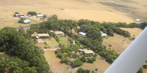
Enjoy the comfort of a home stay, together with access to the world class Wilsons Promontory National Park for day walks.
GRADE | LENGTH | TYPE: Easy – day walks and beach activities.
ACTIVITY DESCRIPTION:
We have a private house at Yanakie overlooking Corner Inlet just near the park entrance. You can come down for as many days as you like. It is quite flexible. There are many nice day walks in the area. We will decide where to walk each day taking into account the condition of the weather and the participants. The base offers hot showers, comfortable accommodation and a log fire to warm up if the day is cold. There is a range of gay themed movies to watch in the evening for movie buffs.
BOOKING: By Monday 29th March. To register, click on Get Tickets.
NOMADS COVIDSAFE CHECKLIST: Checklist 210401 Yanakie/Wilsons Promontory Walks.
FURTHER INFORMATION: www.parks.vic.gov.au/places-to-see/parks/wilsons-promontory-national-park.
MEETING TIME | LOCATION: You can arrive any time from Thursday as arranged with the leader. You will be given location details after registering.
MAP REFERENCE: Melway map X928/628 grid C10 | VicRoads map 103 grid D7 | Google map goo.gl/maps/A8fupz5R28HgD9Ec9. Detailed directions will be provided after the RSVP date.
DISTANCE | TIME FROM GPO: Approximately 195 km. Yanakie is 2.5 hours drive from Melbourne towards Wilsons Promontory.
TRANSPORT: Public transport not available. We will try to maximise car-pooling as parking is limited at the house.
FOOD: Bring supplies for your own breakfast and lunch. Communal night meals will be arranged once the numbers are known. There are staples at the house like sugar, tea etc.
APPAREL | FOOTWEAR: Face mask, hand sanitiser, warm waterproof gear and changes of clothing. Summery attire is also likely to be needed. It might be warm enough to dive into the sea. Light comfortable walking footwear.
ACCOMMODATION: There are a limited number of beds for the early birds, some floor space and plenty of tent space in the garden. Bring linen and towels.
COST: Free entry to the National Park. Donation towards any meals that are provided.
LEADER: Roger H. | Email the Leader if you have any questions. Members can access leader contact details under Members | Leader Contacts when logged in to the website.
HOME BACK TO LIST OF EVENTS MEMBERSHIPS

Mar
28
2021
Past Event
Ferry to Portarlington and Bellarine Peninsula Cycling
131 Harbour Esplanade
10:20 – 18:00
For the last weekend prior to the end of daylight saving, take a ferry from Docklands to Portarlington, cycle the Bellarine Peninsula then return to Southern Cross Station (Docklands) by train from South Geelong.
GRADE | LENGTH | TYPE: Medium, approximately 46 km, cycling (plus ferry and train). The route is flat to gently undulating on both cycling paths and roads, with a combination of sealed and gravel surfaces.
ACTIVITY DESCRIPTION:
Enjoy a relaxing, multi-mode tour of the northern Bellarine Peninsula, starting with a ferry ride from Docklands to Portarlington to take in the scenery of the lower Yarra and the Bay. Once docked in Portarlington, we'll have lunch at the Portarlington Golf Club, taking care to not over indulge though as there's work to be done afterwards! (** we had originally planned to dine at the Portarlington Grand Hotel, but unfortunately it's closed for renovations). After dining, we follow the scenic off-road coastal trail around to St Leonards (13 km). There we head inland, riding on-road (mostly unsealed), to meet the Bellarine Rail Trail at Drysdale (13 km). That trail takes us back to South Geelong Station (20.7 km) to catch a V/Line train to Southern Cross, with departures from South Geelong every 20 minutes approximately.
IMPORTANT: There's a limit of 20 bikes on the ferry. Book your ferry ticket early to ensure you don't miss out!
WALKING OPTION: You can also join us for lunch, followed by some relatively easy walks around Portarlington if you wish. Richard Chater will lead those walks. Afterwards, you can either return by ferry (departing Portarlington at 4:30pm) or else catch a bus to Geelong, then V/Line train back to Melbourne.
BOOKING: By Thursday 25th March, or ASAP to ensure you can get your bike on the ferry.
Cycling: To register, click on Get Tickets and also book your ferry ticket to Portarlington, being sure to select the (free) bike option.
Lunch/Walking: to register, click on Get Tickets as normal, but be sure to select your "Preferred Activity" as "Walking" (or "Other" if you only wish to attend the lunch then make your own way home). Note that because of COVID regulations, walkers also need to pre-book your ferry ticket to Portarlington.
NOMADS COVIDSAFE CHECKLIST: Checklist 210328 Ferry to Portarlington and Cycling Bellarine Peninsual.
MEETING TIME | LOCATION: 10:20am at 131 Harbour Esplanade, Docklands to load your bike for a 10:40am ferry departure (which arrives in Portarlington at 11:50am).
COST:
Ferry: Full $16.50 or Concession $15.00. No surcharge for bikes, but they must be booked (limit of 20 bikes)
Lunch: see the Portarlington Golf Club menu
V/Line Train (South Geelong to Southern Cross): the Geelong stations are in Myki Zone 4. The cost for an off-peak Zone 1-4 trip is $9.52 full or $4.76 concession.
MAP REFERENCE: Ferry terminal: Melway map 2E grid G5 | Google map goo.gl/maps/UmmEhXgNVsBYY8SY6.
PUBLIC TRANSPORT: Southern Cross Station is close by. The safest way to ride from Southern Cross Station is to take the Collins Street exit. Turn right onto Collins Street then after 500 metres turn right onto Harbour Esplanade. The ferry will be located on your left after 500 metres.
FOOD: Lunch will be at the Portarlington Golf Club. Carry a litre of water.
APPAREL | FOOTWEAR: Face mask, hand sanitiser, comfortable cycling gear, plus bike, helmet and gloves. Dress according to the weather forecast. A light jacket may be useful regardless of the forecast.
LEADER: Alan D. | Email the Leader if you have any questions.
Members can access leader contact details under Members | Leader Contacts when logged in to the website.
Image: Port Phillip Ferries
HOME BACK TO LIST OF EVENTS MEMBERSHIPS
Mar
27
2021
Past Event
Iconic Inner Gardens Walk and Picnic
Flinders Street Railway Station
10:30 – 16:30
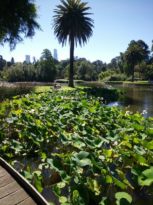
Have a relaxing Saturday walk through the iconic gardens that border the southern edge of the Melbourne Central Business District (CBD) and relax with a BYO picnic lunch on one of the many lawn areas that are dotted throughout the Royal Botanical Gardens.
GRADE | LENGTH | TYPE: Easy, approximately 5 km of walking to/from and within multiple gardens.
ACTIVITY DESCRIPTION:
Meeting in the booking hall at the main entrance to Flinders Street Station, the event will head south along St Kilda Road passing through two major Gardens: Queen Victoria Gardens and Kings Domain. Stops will be made to learn about multiple installations in these Gardens; including MP Pavillon, The Pathfinder Sculpture, The Water Nymph, the Floral Clock and the COVID-19 retrofitted Myer Music Bowl. Time will then be spent exploring the Pioneer Women's Memorial Garden and the Fern Gully Health and Wellbeing Garden before entering the Royal Botanic Gardens (RBG) via the Lych Gate. Must-sees in the RBG are Guilfoyle's Volcano and the newly created Sensory Garden. The latter is best "felt" by walking through it in bare feet!! Depending on crowds and the weather, a spot will be selected for lunch and as a base for exploring the gardens.
BOOKING: By Thursday 25th March. To register, click on Get Tickets.
NOMADS COVIDSAFE CHECKLIST: Checklist 210327 Iconic Gardens Walk.
FURTHER INFORMATION: rbg.vic.gov.au/visit-melbourne or What's On: Queen Victoria Gardens or What's On: Kings Domain.
MEETING TIME | LOCATION: 10:30am at the Booking Hall between the Clocks and the Myki entrance gates off the Flinders Street entrance to Flinders Street Station.
MAP REFERENCE: Melway map 1B grid N10 | Google map goo.gl/maps/B4c19Q8yRQjAA3KF7.
PUBLIC TRANSPORT: Multiple train, tram and bus routes either arrive at or within a short walk of Flinders Street Station. Cost is free for those with a Myki Pass or Seniors card. Myki Money daily weekend fares are capped at $6.50 full fare and $3.25 for concession holders.
FOOD: Carry lunch, snacks and at least 1 litre of water.
APPAREL | FOOTWEAR: Face mask, hand sanitiser, comfortable walking boots/shoes and dress according to the weather forecast.
LEADER: Garry Oliver | Email the Leader if you have any questions.
Members can access leader contact details under Members | Leader Contacts when logged in to the website.
HOME BACK TO LIST OF EVENTS MEMBERSHIPS