The Nomads Outdoors Group Inc.
Powered by
Past events
All events
Past events
Jan
08
2022
Past Event
*** Postponed *** Men only Naturist Beach Day at Somers + Men's Naturist Afternoon Tea at Bittern
121 Miramar Rd
10:30 – 16:00
*****************EVENT POSPONED****************
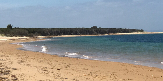
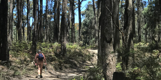
Enjoy a relaxed day out at the Somers naturist beach.
GRADE | LENGTH | TYPE: Easy 7 km circuit walk. It is a pleasant 3.5 km walk along the beach from the car park in Somers towards Sandy Point to a good setup place in the sand dunes. The sand is fairly firm. Walking time is generally about 55 minutes to the setup place. Most of the beach walk can be done minus clothes once we get past the local dog walkers close to Somers. Of course it is another approx 3.5 km back to the cars at the end of the day.
ACTIVITY DESCRIPTION:
This event is for naturists. Enjoy a pleasant relaxing beach day - walk, swim and sunbake with other fellow naturists.
After the beach we have been invited to a men's naturist afternoon tea at a fellow nudist's residence in Bittern, 10 minutes drive away. Afternoon tea, drinks and snacks will probably start around 5pm. (Apologies, the afternoon tea is a men's-only gathering).
BOOKING: By Wednesday 5th January. To register, click on Get Tickets.
Unsure if you've already booked? Click View my bookings.
NOMADS COVIDSAFE CHECKLIST: Checklist 220108: Beach Day at Somers.
MEETING TIME | LOCATION: 10.30am in the car park at 121 Miramar Rd, Somers.
There is no cafe near the meeting place sorry, you will need to bring your coffee with you. (You can get coffee in Bittern at Remuce Cafe or the Bittern Bakery and Cafe).
We plan to depart from the car park for the beach at about 11am. If you should miss us, or wish to come at a different time, walk to the side of the car park nearest the beach and go down the steep steps to the beach. At the bottom of the stairs turn left and walk for about 55 minutes and you should find our camp.
Food Drop off in the Morning: If you'd like to drop off food before you come to the beach, you may drop it at the house in Bittern between 9.45am and 10.15am. The house is 1 hour 20 minutes, and 82 km from Melbourne - a long way! Make sure you plan your time. From the house to the meeting place it is a 10 minute drive.
Address of the Afternoon Tea House: This will be emailed to all those who have booked by 10pm on Wednesday 5th January. It will also be given out on the beach day.
TIDE FORECAST: Low 11:48am - High 6:09pm - Low 11:50pm. The tide will be out when we leave from the carpark for the beach may starting to getting higher when we leave the beach to come back in the afternoon. (For those who haven't been to Somers, it is quite difficult to climb over the fallen trees on the beach at high tide.)
MAP REFERENCE: Melway map 194 grid F11 | Google map goo.gl/maps/6AUdGMw3E9BwtP38A.
DISTANCE | TIME FROM GPO: 86 km, about 1 hour 20 minutes to 1 hour 30 mins depending on which route you take.
FOOD:
FOOD and BEVERAGES for the BEACH DAY: Carry lunch, water and any other food/drinks you may like for the beach day.
FOOD and DRINKS for the AFTERNOON TEA: Please bring some food to share for afternoon tea at the Bittern residence after the beach day. Tea and coffee will be provided. Bring cold drinks if you would prefer those.
APPAREL: Sunscreen, hat, sun glasses, footwear if the sand is hot. Shorts required to get from car park to the naturist beach.
EQUIPMENT: Towel. A picnic blanket with plastic backing or a large plastic sheet is handy, because in some places the grass seeds stick tightly to your towel and are very hard to get out. You may wish to bring a sun shelter. The tea tree provides quite good, but not complete, shade cover. Sporting equipment such as a frisbee, tennis ball, larger ball, small cricket bat etc. could be fun.
LEADER: Peter H. | Email LeaderPeterH.thenomadsinc@mail.tidyhq.com if you have any questions.
Members can access leader contact details under Members | Leader Contacts when logged in to the website.
HOME BACK TO LIST OF EVENTS MEMBERSHIPS
Jan
03
2022
Past Event
Ballarat Foto Biennale - Walking Tour & Pub Lunch: Continues into 2022
Southern Cross
09:00 – 18:30
** This event has been interrupted due to Covid-19 lockdown restrictions. The exhibition has been extended until 9th January 2022. Monday, 3rd January is a public holiday in lieu of New Year's Day**
Pound the streets in the historic inner precinct of Ballarat, visiting the multiple locations hosting exhibitions for the extended 2021 International Foto Biennale. Travel via public transport is possible.
GRADE | LENGTH | TYPE: Easy, approximately 5 km, circuit walk on flat paths.
ACTIVITY DESCRIPTION:
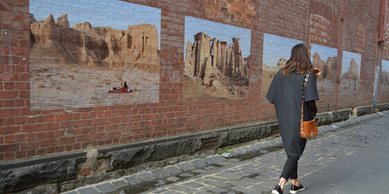
Ballarat is home to the National Centre for Photography (NCFP) housed in the old Union Bank building on Lydiard Street North. It's the base for the team behind BIFO.
The Ballarat International Foto Biennale was founded in 2005 and attracts significant international and Australian photographers as one of Australia's pre-eminent photographic festivals. The multiple exhibitions, both free and ticketed, are housed in various historic buildings, laneways and cafes. Full details of the program are available online at ballaratfoto.org. Most exhibitions are open daily from 10am to 5pm.
The featured ticketed events this year include two international exhibitions:
(1) The (late) Linda McCarthy's Retrospective at the Art Gallery of Ballarat, and
(2) Notes From A Queer Mystic, an exhibition of work by the late USA artist, Steven F Arnold (1943 to 1994) at the NCFP building.
Check ballaratfoto.org for details of purchasing 1-day passes to visit the multiple ticketed events.
BOOKING: By Friday 31st December. To register, click on Get Tickets.
Unsure if you've already booked? Click View my bookings.
NOMADS COVIDSAFE CHECKLIST: Checklist 220103: Ballarat Foto Biennale - Walking Tour & Pub Lunch.
MEETING TIME | LOCATION: 10:45am at the Ballarat Railway Station, Lydiard Street North. Travel options are (1) by train (see details below) or (2) driving and parking on the fringes of the Ballarat CBD, as on-street parking in the CBD is time limited and fees may be payable.
MAP REFERENCE: Ballarat Station - Melway map 611 grid A12 | Google map goo.gl/maps/KjS3JEEYfng9UvaE7.
DISTANCE | TIME FROM GPO: 114 km, approximately 1 hour 25 minutes to drive, 1 hour 29 minutes by public transport.
PUBLIC TRANSPORT: The trip is on the train departing Southern Cross Station at 9:16am arriving at 10:41am. It's suggested that we gather in the first carriage (North Melbourne end). Return trains depart Ballarat regularly, for example: 3:24pm, 4:04pm, 4:18pm (coach), 4:48pm and 5:33pm.
FOOD: A booking will be made for a 12:30pm lunch at Irish Murphy's Hotel, 36 Sturt St, Ballarat for those interested. Otherwise do your own thing in between visiting exhibition sites.
APPAREL | FOOTWEAR: Comfortable walking shoes and dress according to the weather forecast.
LEADER: Garry Oliver | Email LeaderGarryO.thenomadsinc@mail.tidyhq.com if you have any questions.
Members can access leader contact details under Members | Leader Contacts when logged in to the website.
Image: Rove.me
HOME | BACK TO LIST OF EVENTS | MEMBERSHIPS
Jan
02
2022
Past Event
Emerald Lake and Lake Nobelius Loop
The Gem Community Arts Centre
11:00 – 16:00
The Emerald Lake and Lake Nobelius Loop is a loop trail located east of Melbourne, that features a lake and is rated as easy.
GRADE | LENGTH | TYPE: Easy 10 km circuit walk, mostly flat, and on easy trails.
ACTIVITY DESCRIPTION:
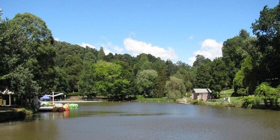
The Emerald Lake and Lake Nobelius Loop is a 10 km moderately trafficked loop trail located east of Melbourne, in the southern Dandenongs. The trail is primarily used for hiking, walking, running and bird watching. Dogs are also able to use this trail but must be kept on leash.
Emerald Lake Park and Nobelius Heritage Park form the Emerald Lake Precinct. Both parks are owned and managed by Council. The park covers an area of roughly 52 hectares and features Lake Treganowan and Lake Nobelius, ornamental exotic trees and natural bushland. It is home to both native and exotic plants, with fern gullies and open eucalypt forests. The ornamental trees are spectacular, and some significant trees are listed with the National Trust of Australia.
Many animals that live in the park are nocturnal and can be harder to spot during the day. However, you might see lyrebirds, purple swamp hens, Eurasian coots, ducks, dusky moorhens, kookaburras, rosellas, echidnas and black wallabies. The park is one of Puffing Billy Railway’s key destinations.
Four and a half hectares was part of the world-famous Nobelius Nursery, started in 1886 by Swedish immigrant Carl Axel Nobelius. The nursery exported fruit and ornamental trees to five continents and, through the supply of exotic trees to municipalities throughout Australia, had a significant influence on the nation's landscapes. The nursery covered more than 650 hectares at its peak just before WWI, employed 80 people and was the largest exporter of fruit and ornamental trees in the Southern Hemisphere.
BOOKING: By Thursday 30th December. To register, click on Get Tickets.
Unsure if you've already booked? Click View my bookings.
NOMADS COVIDSAFE CHECKLIST: Checklist 220102: Emerald Lake and Lake Nobelius Loop.
FURTHER INFORMATION: www.cardinia.vic.gov.au/info/20036/emerald_lake_park/612/about_emerald_lake_park
MEETING TIME | LOCATION: 11am outside The Gem Community Arts Centre, just south of the centre of Emerald.
MAP REFERENCE: Melway map 127 grid E5 | Google map goo.gl/maps/oeVqgt4q9ibuugeJ9
DISTANCE | TIME FROM GPO: 55 km, 1 hour. The quickest route is via the M1, Wellington Rd (C413) then Belgrave-Gembrook Rd (C412).
PUBLIC TRANSPORT: It is possible to take public transport, but that involves both train (Belgrave Line) and bus (#695), taking more than two hours.
FOOD: Carry lunch, snacks and at least 1 litre of water.
APPAREL | FOOTWEAR: Comfortable walking boots/shoes and dress according to the weather forecast.
LEADER: Richard C. | Email LeaderRichardC.thenomadsinc@mail.tidyhq.com if you have any questions.
Members can access leader contact details under Members | Leader Contacts when logged in to the website.
HOME BACK TO LIST OF EVENTS MEMBERSHIPS
Jan
01
2022
Past Event
New Year's Day BYO Picnic
Hays Paddock
12:00 – 17:00
Join fellow NOMADS for a relaxing afternoon to celebrate a start to (a better hopefully) 2022 in the inner eastern suburbs of Melbourne and enjoy the first outdoors social events for the year.
GRADE | LENGTH | TYPE: Easy, with a gentle post lunch stroll of this unique site.
ACTIVITY DESCRIPTION: Hays Paddock is the most visited active and passive recreation space in the City of Boroondara. At the time of European settlement, this rich floodplain was occupied by the Wurundjeri tribe. Crown land sales in 1845 saw Englishman William Oswin successful, and it became a dairy farm known as Kilby Farm. Talk of turning the area into open recreation space commenced in 1943 after many floods. It was finally completed in its current form after re-arrangement of land in both North and East Kew with the building of the Eastern Freeway.
The Paddock is planted with native trees and bushes. Glass Creek, which originates in Greythorn, passes through the park on its way under the Eastern Freeway to join the Yarra River. There is a wetlands area with an associated hide for bird watching.
A shelter pavilion, BBQ, water taps and toilets are available at the site.
BOOKING: By Friday 31st December 2021. To register, click on Get Tickets.
Unsure if you've already booked? Click View my bookings.
NOMADS COVIDSAFE CHECKLIST: Checklist 220101: New Year's Day BYO Picnic.
FURTHER INFORMATION: www.boroondara.vic.gov.au/recreation-arts/parks-and-gardens/hays-paddock
MEETING TIME | LOCATION: From 12 Noon in shade next to the Glass Creek just due east from the three (3) cricket practice nets. Its a short walk from the car park off Leason / Longstaff Streets entrance to the Paddock in East Kew. (If the main car park is full, on-street parking occurs in both Leason and Longstaff Streets).
MAP REFERENCE: Melway map 45 grid J2 | Google map goo.gl/maps/vthct51X7Vo8Lzvb7.
TRANSPORT: 6 km from GPO, approximately 20 minutes to drive. Public transport options are (1) Tram #48 to Stop 41 Clyde Street + Buses 200 and 207 to Leason Street. If travelling via public transport, myki money public holiday capped fares apply ($6:70 full fare and $3.35 concession) + free for Seniors. Cycling via the Main Yarra Trail, exit at Belford Road (Kew Golf Club) and cycle along the bike lane on Kilby Road
FOOD: BYO picnic supplies - BBQ available, but it may be popular on a public holiday. Recommend you also bring a camper chair or rug to sit on. Ample trees to protect from the sun.
APPAREL | FOOTWEAR: Comfortable walking shoes and dress according to the weather forecast.
LEADER: Garry Oliver. | Email LeaderGarryO.thenomadsinc@mail.tidyhq.com if you have any questions.
Members can access leader contact details under Members | Leader Contacts when logged in to the website.
HOME BACK TO LIST OF EVENTS MEMBERSHIPS

Dec
12
2021
Past Event
Trentham Wombat Trail Walk: Sunday 12th December
High Street & Quarry Street
11:00 – 15:00
A short walk within historic Trentham and part of the Wombat Trail, a loop that goes around the edges and through Trentham along well made paths.
GRADE | LENGTH | TYPE: Easy, approximately 7.5 km, circuit walk on formed paths.
ACTIVITY DESCRIPTION: Trentham is a small town on the edge of the Wombat State Forest. There are a number of reserves and walking trails around this historic area, including part of the Wombat Trail, a loop of approximately 7 km, taking the walker around the edge of the Victorian town into the surrounding bushland. The path runs upstream along Stoney Creek and its native bush reserve. After leaving Stoney Creek, you reach the historic Trentham Cemetery (est 1870). Crossing over the Trentham-Blackwood Road we enter Rahills Rd & Golden Point Rd past the Trentham Racecourse, where the last race was run 110 years ago. Returning to Trentham we will make our way back to town via the old Police Camp Reserve, in Camp St (no pun intended), containing a preserved old jail built in 1866. Back into the Trentham township past the historic Red Beard Bakery (run continuously since 1890s) and then onto the 1880s Trentham Railway Station and along the railway line. We return to the Quarry St/High St intersection for the end of the loop and picnic lunch/bbq facilities within the Quarry Street Reserve.
BOOKING: By Thursday 9th December. To register, click on Get Tickets. If you wish to stay on Saturday night, select Saturday from the Accommodation Nights question when booking.
Unsure if you've already booked? Click View my bookings.
NOMADS COVIDSAFE CHECKLIST: Checklist 211212: Trentham Wombat Trail Walk.
It is strongly recommended that you only attend the event if you have been fully vaccinated against COVID-19. Those staying overnight on Saturday night MUST be double vaccinated.
MEETING TIME | LOCATION: 11am on the south side of the Quarry St / High St intersection, Trentham.
MAP REFERENCE: Melway map X909 grid E10 | Google map goo.gl/maps/76ktsq5uc4igUVdr5.
DISTANCE | TIME FROM GPO: 93 km, between 75 and 90 minutes to drive via the M79 Calder Fwy. Parking is available in Quarry St, on the north and the south side of its intersection with High Street (the main Trentham throughfare and just downhill from the Cosmopolitan Hotel).
PUBLIC TRANSPORT: Public transport options are available via train between Southern Cross station and Woodend (or Kyneton), plus a bus to Trentham. Myki cannot be used on the Daylesford bus service - tickets should be purchased online in advance. Recommended options:
Getting There: From Southern Cross, catch the 9:05am Echuca service and alight at Woodend at 10:04am. Transfer to the Daylesford bus service that departs from Woodend at 10:14am and arrives at Trentham Milk Bar/Market St at 10:36am. The bus stop is about 300 metres from the meeting point - from the bus stop head north, then turn left into High St (C318). The second High St intersection is Quarry St, the meeting point.
Returning: either Trentham 2:39pm arriving Southern Cross 4:24pm or Trentham 5:39pm arriving Southern Cross 7:24pm.
For either of these services, catch the Daylesford-Woodend bus service from Trentham Milk Bar/Market St, which should arrive in Woodend to connect to the V/Line train service to Southern Cross Station, departing Woodend about 15 minutes later.
OVERNIGHT OPTION: There is the possibility of staying overnight, as there is space to pitch your tent, campervan etc in the grounds of the leader's home in Trentham, with access to bathroom facilities. There are also a couple of spots available inside the house for lilos. This may be of particular interest to those attending the nearby Mixed Naturist Walk: Wombat State Forest & old logging camps near Blackwood event on Saturday 11th December.
FOOD:
Sunday Lunch: a BYO BBQ will be held at Quarry Street Reserve. BYO meat or vegetarian options for a BBQ lunch beside the meeting point.
Saturday Dinner: for those choosing to spend Saturday night in Trentham, a BYO BBQ will be held at the leader's property in Trentham. BYO everything.
APPAREL | FOOTWEAR: Comfortable walking boots and warm, waterproof layers. Trentham is at 700 metres elevation, so it's likely to be cooler and wetter than Melbourne and the trails may be muddy.
LEADER: Robert H. | Email LeaderRobertH.thenomadsinc@mail.tidyhq.com if you have any questions.
Members can access leader contact details under Members | Leader Contacts when logged in to the website.
HOME BACK TO LIST OF EVENTS MEMBERSHIPS
Dec
11
2021
Past Event
Mixed Naturist Walk: Wombat State Forest & old logging camps near Blackwood
Blackwood Post Office and Cafe
10:00 – 16:00
Enjoy a naturist walk through the forest, and a jaunt along the top of the Great Dividing Range.
GRADE | LENGTH | TYPE: Easy to medium 8 to 9 km circuit walk along 4WD tracks, the occasional walking track and through the open forest. The tracks are generally easy walking with only a couple of short steep sections, but we will take our time.
ACTIVITY DESCRIPTION:
This event is for naturists. We plan to visit some of the old tree logging camps, set up many years ago and now abandoned. Since the logging days the trees have regrown very well and are now quite impressive. At times it feels like you are in a huge auditorium with the roof supported by huge wooden pillars. We will also be able to do a short stroll along the picturesque Lerderderg River very close to where it begins on the top of the range. The walk is planned to finish by 4pm.
Afternoon Tea/Drinks: After the walk we will return to the Blackwood township, where we can have cool drinks, a beer or a coffee at the Blackwood Hotel at 22 Martin St, Blackwood.
BOOKING: By Thursday 9th December. To register, click on Get Tickets.
Unsure if you've already booked? Click View my bookings.
NOMADS COVIDSAFE CHECKLIST: Checklist 211211: Wombat State Forest & old logging camps walk.
MEETING TIME | LOCATION: 10:00am on the footpath outside the Blackwood Post Office andCafe at 23 Martin St Blackwood. They serve coffee, tea and toasties etc. From the meeting place we can do a car convoy, or you can take your car to the start of the walk which is about 8 km away on a 2WD gravel road. Mobile coverage at the cafe is poor. You can try this Optus mobile number 0421 730 686, or if that fails try this Telstra number 0439 185 059.
MAP REFERENCE: Meeting point: Melway map 909 grid E11 | Google map https://goo.gl/maps/zuSsWUBhhPSF3ZzeA The walk start is located west of the cafe, a little bit off Lerderderg Rd.
DISTANCE | TIME FROM GPO: 91 km. Approximately 1 hour 10 minutes.
PUBLIC TRANSPORT: V/Line train leaves Southern Cross Railway Station at 8:16am and arrives in Ballan Railway Station at 9:21am. From here we will need to arrange a pick up for you. If you'd like a lift from Melbourne, when registering, select YES for the Do you need transport to the Event? question, and we can probably arrange a ride for you.
FOOD: Lunch, snacks, water/drinks to take on walk.
COST: $5, free for Nomads members.
APPAREL | FOOTWEAR: Comfy shoes/boots. Sunscreen, sunhat, sunglasses. Small towel to dry off if we find a swimming hole. Shorts could be needed at the start and finish of the walk. You could probably share a day pack between two if you like.
LEADER: Russell W. | Email LeaderRussellW.thenomadsinc@mail.tidyhq.com if you have any questions.
Members can access leader contact details under Members | Leader Contacts when logged in to the website.
HOME BACK TO LIST OF EVENTS MEMBERSHIPS
Dec
11
2021
Past Event
Cycling Round the Bay Lite, with overnight in Ocean Grove
Southern Cross Station
11 Dec 2021 09:20 – 12 Dec 2021 19:00
Enjoy a “Round The Bay Lite” scenic tour from South Geelong to Frankston, with an overnight stay in Ocean Grove. ** Limit of 10 riders **
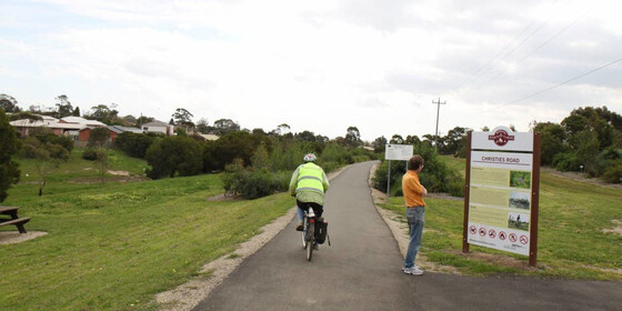
GRADE | TYPE | LENGTH: Hard 139 km point-to-point cycling (Day 1: Hard 61 km | Day 2: Hard 78 km). The route has many on-road sections as well as both sealed and unsealed cycling trails, and very limited early exit options. (The official Round The Bay ride of more than 210 km in a single day is totally off the Nomad’s grading scale)!
ACTIVITY DESCRIPTION: This is a two day cycling weekend with an overnight stay in a private house in Ocean Grove. FOR THE PEACE OF MIND OF ALL ATTENDEES, WE REQUIRE YOU ARE COVID VACINATED SINCE WE WILL ALL BE IN THE HOUSE.
Saturday: we'll travel via V/Line train to South Geelong then cycle to Ocean Grove via roads and trails passing by Southside Beach, Torquay, Point Impossible Beach and Thirteenth Beach.
Sunday: we'll cycle to Queenscliff to catch the ferry across to Sorrento. From there we'll cycle via the Bay Trail to Safety Beach after which we'll head inland. First through some quiet, scenic suburban streets, Bruce Rd and the Nepean Hwy to The Briars Community Forest. We'll cycle/walk through the wetlands then some quiet suburban streets to Old Moorooduc Rd, which takes us on a wide shoulder to the start of the Peninsula Link Trail. From there it's an excellent, wide path all the way to the Baxter Trail for the final 4 km descent to Frankston Station.
Notes:
You will need a sleeping bag (or similar), pillow slip and towel. If attending the Nomads Christmas BBQ, bring it there for it to be transported to Ocean Grove for you.
We will abort the Sorrento to Frankston ride on Sunday if any of the following occur: a threat of rain; a forecast for hot temperature; or the likelihood of a strong headwind. If that happens, we'll probably ride to Portarlington and catch the ferry to Southbank, or else cycle to South Geelong.
BOOKING: By Wednesday 8th December or ASAP. To register, click on Get Tickets. Limit of 10 participants. If sold out, email LeaderRogerH.thenomadsinc@mail.tidyhq.com to see if any other arrangements are possible.
NOMADS COVIDSAFE CHECKLIST: Checklist 211211 Cycling Round the Bay Lite.
FURTHER INFORMATION: www.railtrails.org.au/trail?view=trail&id=139
MEETING TIME | LOCATION: 9:20am at Southern Cross Station to catch the 9:50am Waurn Ponds service (though we will exit at South Geelong Station, due to the bus replacements between South Geelong and Waurn Ponds).
MAP REFERENCE: Melway map 1E grid A9 | Google map goo.gl/maps/WUzR7kSmTVzW3yjx6.
DISTANCE | TIME FROM GPO: around 90 km to South Geelong Station, 1 hour 8 minutes by train from Southern Cross Station.
ACCOMMODATION: basic, but comfortable accommodation will be provided in a private house in Ocean Grove. Only 10 beds are available.
COST:
Ferry: $15 full fare or $13 concession. Bikes are carried at no additional charge.
Lunches: will be purchased individually en route each day.
Accommodation & Meals: a small contribution is suggested to contribute to breakfast and accommodation expenses.
PUBLIC TRANSPORT: Travel to and from this event is via public transport.
Sat 11 Dec: meet at Southern Cross Station at 9:20am to catch the 9:50am train to South Geelong.
Sun 12 Dec: trains depart Frankston every 10 minutes for Flinders Street.
FOOD: Carry 2 litres of water. We will purchase lunch along the way, though there will be long stretches with no food options, so it would be advisable to bring some snacks.
APPAREL | FOOTWEAR:
A hybrid bike is best due to the diversity in tracks. Quite a lot of the route will be on sealed trails or roads, but some of the tracks, including the sealed sections, can be quite rough. Bring clothing based on the weather forecast, but be prepared for changeable conditions.
You will need a sleeping bag (or similar), pillow slip and towel.
LEADER: Roger H. | Email LeaderRogerH.thenomadsinc@mail.tidyhq.com if you have any questions.
Members can access leader contact details under Members | Leader Contacts when logged in to the website.
Image: railtrails.org.au
HOME BACK TO LIST OF EVENTS MEMBERSHIPS
Dec
11
2021
Past Event
*POSTPONED DUE TO TRAINS REPLACED BY BUSES* Rail Trail Cycling - Warrnambool to Port Fairy & Overnight at Port Fairy
Southern Cross
11 Dec 2021 06:50 – 12 Dec 2021 21:15
** This event is fully booked, but has been postponed due to V/Line being unable to transport bikes on these dates, unless transport via car can be arranged. **
With your bicycle, explore South West Victoria with a return cycle on the Warrnambool to Port Fairy Rail Trail. Travel from Melbourne by train with ample time to explore Koroit, Port Fairy and Warrnambool. Enjoy group accommodation in the historic building that now contains the Port Fairy YHA.
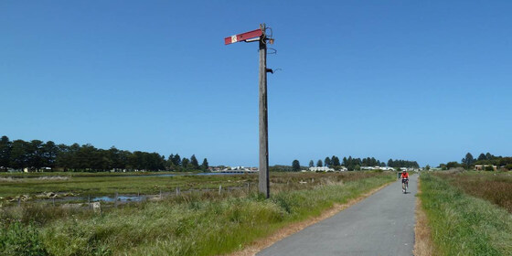
GRADE | LENGTH | TYPE: Medium, 38 km one way on sealed and gravel paths that are mainly flat.
ACTIVITY DESCRIPTION:
With daylight saving in operation and warmer weather in play, it's a good time to explore the stunning natural environment in South West Victoria at a leisurely pace on our bicycles. The cycling will take place on the trail that opened in May 2012 replacing the former branch train line from Warrnambool to Port Fairy after the rail service closed in 1977. The trail is noted for spectacular scenery on the section from Koroit to Port Fairy.
Equally, Port Fairy has a variety of attractions to explore given its position on the Moyne River and Bass Strait.
BOOKING: ASAP and no later than Tuesday 7th December. To register, click on Get Tickets.
Unsure if you've already booked? Click View my bookings.
FURTHER INFORMATION: portfairyaustralia.com.au/plan-your-trip/visitor-information-centres-2
MEETING TIME | LOCATION: 6:40am at Southern Cross Station for departure on the Warrnambool train at 6:55am.
TRAVEL FROM/TO MELBOURNE: Saturday departure is at 6:55am - allow an extra 15 minutes to ensure your bicycle is loaded into the luggage compartment at the rear of the first class carriage. The train arrives at Warrnambool at 10:45am (3 hours and 50 minutes).
Return trip from Warrnambool on Sunday starts at 5:32pm and arrives back at Southern Cross at 9:09pm (3 hours and 37 minutes).
Return Fares are $78.40 Full and $39.20 Concession and Seniors. Free Travel Vouchers can be "cashed in" for this trip.
Another option is to drive to Warrnambool, park the car near the station and cycle with the train group.
MEAL OPTIONS:
Saturday Breakfast - BYO onto the train with multiple purchase options at Southern Cross Station including a Woolworths Metro Store that opens at 5:30am.
Saturday and Sunday Lunch - at Koroit with multiple options including pubs, bakery, etc.
Saturday Dinner - (1) pool funds to purchase food for a BBQ on site at the YHA (plus BYO your beverages of choice) or (2) a pub meal at one of the local venues (NOTE - dress codes may apply which impacts the amount of gear you pack into your panniers).
Sunday Breakfast - local eateries plus there is a large communal kitchen at the YHA to prepare your BYO food.
Sunday Dinner - purchase supplies in Warrnambool for eating on the train or trust the limited train buffet options.
ACCOMODATION: The overnight stay will be at the Port Fairy YHA, 8 Cox Street. A reservation has been made for two bunk rooms; this can be increased. Plus, alternative rooms are available such as 2-person occupation. Linen and towls ($2 surchage for the latter) are provided. Expect to pay between $30 to $35 per person for your overnight stay. Check-in is from 4pm on Saturday and Checkout is before 10am on Sunday.
APPAREL | FOOTWEAR: Cycling layers to cater for any eventuality - be sure to bring some rain protection. A spare bike tube(s) is imperative if your bike wheel size is non-standard.
LEADER: Garry Oliver | Email LeaderGarryO.thenomadsinc@mail.tidyhq.com if you have any questions.
Members can access leader contact details under Members | Leader Contacts when logged in to the website.
Image: RailTrails.org.au
HOME BACK TO LIST OF EVENTS MEMBERSHIPS
Dec
07
2021
Past Event
Annual Pre-Christmas BBQ
Yarra Bank Reserve
18:30 – 21:00
Join us for the popular annual Christmas BBQ beside the Yarra River in a tranquil, little-known park in Hawthorn.
GRADE: Social.
ACTIVITY DESCRIPTION:
Join your friends on the banks of the Yarra River at Hawthorn for a pre-Christmas BBQ in lieu of our monthly indoors social evening. The venue is a secluded spot that is protected from wind and extreme sun. The reserve has four tables with bench seats and two BBQs. Water is on-tap and a public toilet is located on Creswick St.
BOOKING: By Sunday 5th December. To register, click on Get Tickets.
Unsure if you've already booked? Click View my bookings.
NOMADS COVIDSAFE CHECKLIST: Checklist 211207: Annual Pre-Christmas BBQ.
MEETING TIME | LOCATION: From 6:30pm at Yarra Bank Reserve, on the Hawthorn side of the Yarra River (“under” the Bridge Rd bridge).
MAP REFERENCE: Melway map 2H grid H6 | Google map goo.gl/maps/mjZWxZRLASy.
DISTANCE | TIME FROM GPO: 5 km by car – enter the reserve via the corner of Creswick and Denham Streets, Hawthorn or park in Creswick St.
PUBLIC TRANSPORT: Trams are best, to tram stop 23 (Burwood Road / Church Street junction) via either route 48 (from Collins St) or route 75 (from Flinders St). Alternatively, it's a 15 minute walk from Hawthorn Station, on the Lilydale, Belgrave and Alamein lines.
FOOD: The Nomads will supply pre-meal nibbles plus bread and salads to accompany the main meal. You need to BYO your preferred main meal item for the BBQ. All beverages are BYO. A limited supply of disposable plates, cups and cutlery will be available. You are recommended to bring your preferred utensils.
APPAREL | FOOTWEAR: Daylight saving will be active. Bring insect repellent plus a lightweight and waterproof jacket if showers are forecast. It is likely to turn cool once the sun sets.
LEADER: Garry O. | Email LeaderGarryO.thenomadsinc@mail.tidyhq.com if you have any questions.
Members can access leader contact details under Members | Leader Contacts when logged in to the website.
HOME BACK TO LIST OF EVENTS MEMBERSHIPS
Dec
05
2021
Past Event
Churchill National Park Walk
Churchill National Park
11:00 – 16:00
A short walk in the Churchill National Park in the southern Dandenongs, with panoramic views and a high probability of sighting native wildlife.
GRADE | LENGTH | TYPE: Easy, about 8 km circuit walk with a total climb of 225 metres.
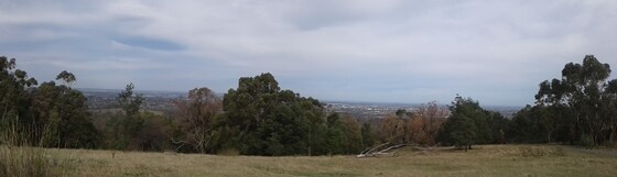
ACTIVITY DESCRIPTION: Churchill National Park, located in Melbourne's south-eastern suburbs, remains an example of the original landscape found in the region before clearing and settlement took place. Although most of the park is open regrowth woodland, there are small areas of original forest. There are many kangaroos in the park (several seen on the preview). We shall be mostly following gravel tracks, with a rise of 225 metres to the Lysterfield Hills Trig Point, and panoramic views over eastern and southern Melbourne.
FURTHER INFORMATION: parks.vic.gov.au/places-to-see/parks/churchill-national-park.
BOOKING: By Thursday 2nd December. To register, click on Get Tickets.
Unsure if you've already booked? Click View my bookings.
NOMADS COVIDSAFE CHECKLIST: Checklist 211205: Churchill National Park Walk.
MEETING TIME | LOCATION: 11am | The walk begins at the Churchill Picnic Area, Army Track, off (and near) Churchill Park Drive. There are several small parking areas – meet at the covered BBQs.
MAP REFERENCE: Melway map 82 grid C11 | Google map goo.gl/maps/wPoFMUTfLuUgD6R17.
DISTANCE | TIME FROM GPO: 38 km, 45 minutes. There is no viable public transport.
FOOD: Pack food for lunch and snacks. At least 1 litre of water should be carried.
APPAREL | FOOTWEAR: Wear a hat or beanie, clothing to meet the forecast weather conditions and footwear suitable for walking along mostly gravel paths.
LEADER: Richard C. | Email LeaderRichardC.thenomadsinc@mail.tidyhq.com if you have any questions.
Members can access leader contact details under Members | Leader Contacts when logged in to the website.
HOME BACK TO LIST OF EVENTS MEMBERSHIPS

Nov
28
2021
Past Event
William Cooper Kristallnacht Walk
Cross Street & Hocking Street
10:00 – 16:00
Enjoy a scenic walk from West Footscray to the Maribynong Valley path to Victorian Kensington and then on through tree-lined streets in North Melbourne to Collins Street.
This walk commemorates the 1938 peaceful protest march led by William Cooper. The exact path of his route is not known now unfortunately so while this walk will commence from his house, where he started his walk and will end up at the former German Consulate in Collins St where his protest march ended, our route is designed to take in a more scenic walking route than his 1938 route probably was.
Afternoon tea/coffee can be enjoyed in a nearby cafe in Collins St to conclude the walk.
GRADE | LENGTH | TYPE: Easy, approximately 15 km, point-to-point walk mostly on flat paths though with a descent to the Maribynong River path and with some slightly steeper street walking through North Melbourne. Public transport connections along the way.
ACTIVITY DESCRIPTION: William Cooper was an inspiring indigenous leader whose public advocacy of justice for the Aboriginal people of Australia commenced on a soap box on the banks of the Yarra River in the 1920s.
He founded the Aboriginal Advancement League from his home in Footscray.
He attempted to present a petition to the German Consul protesting at the physical abuse of Jewish people, the burning of their synagogues and stores by the Nazi SA paramilitary forces on the nights of 9th and 10th November 1938.
This infamous escalation in Nazi violence against German Jews is called Kristallnacht - in English, Crystal Night, from the broken glass.
Despite the opression and neglect of his own people, William Cooper responded with empathy and righteous anger at the oppression of another group of human beings.
PODCAST (4 November 2021, 28 minutes 25 seconds): Historian Bain Attwood shares his insights into the long and productive life of William Cooper in an interview by Phillip Adams on Late Night Live (ABC Radio National).
BOOKING: By Thursday 25th November. To register, click on Get Tickets.
Unsure if you've already booked? Click View my bookings.
COVIDSAFE CHECKLIST: Checklist 211128: William Cooper Kristallnacht Walk.
MEETING TIME | LOCATION: 10am at the West Footscray station entrance in Cross St --on the Whitten Oval side of the station.
MAP REFERENCE: Melway map 41 grid K4 | Google map goo.gl/maps/6fWUHjuYy3jUkRzd7.
PUBLIC TRANSPORT: The Sunbury line train that departs Flinders Street Station platform 9 at 9:43am arrives at West Footscray Station at 9:56am. Please double check the platform number when you arrive at Flinders St in case of platform changes.
Parking available beside the station.
FOOD: Carry lunch, snacks and at least 1 litre of water.
APPAREL | FOOTWEAR: Comfortable walking boots/shoes and dress according to the weather forecast.
LEADER: Don V. | Email LeaderDonV.thenomadsinc@mail.tidyhq.com if you have any questions.
Members can access leader contact details under Members | Leader Contacts when logged in to the website.
Image: globalreconciliation.org
HOME BACK TO LIST OF EVENTS MEMBERSHIPS

Nov
27
2021
Past Event
Mt Feathertop overnight hike: 26-28 November
27 Nov 2021 09:30 – 28 Nov 2021 17:00
This is a chance to experience some magnificent scenery in Victoria’s High Country, as well as to get some quite serious exercise. It involves one night's camping on the track.
GRADE | LENGTH | TYPE: Hard backpacking. Previous overnight hiking experience is highly recommended and a reasonable level of fitness is essential. Walk is up and down a long, steep track (1,100m vertical drop over 11 km).
ACTIVITY DESCRIPTION: While originally planned as a one-way hike, starting at Diamantina Hut near Mt Hotham, due to adverse weather conditions, this is now an out-and-back walk from Harrietville.
SATURDAY
A strenuous 6 or 7-hour walk up Bungalow Spur brings us to Federation Hut. The hut is of relatively recent construction, and has a long-drop toilet nearby. There are spacious adjacent lawns on which to set up your tent.
There is the option of a return excursion (3 km, 2 hours) from our campsite to the summit of Mt Feathertop, although Sunday morning may be a better window to do this.
SUNDAY
After an optional return excursion (3 km, 2 hours) from our campsite to the summit of Mt Feathertop, we return down Bungalow Spur from our campsite to Harrietville. This section of the walk will take about 3-4 hours.
BOOKING: By Tuesday 23rd November. To register, click on Get Tickets. The event is limited to 12 participants. Unsure if you've already booked? Click View my bookings.
COVIDSAFE CHECKLIST: Checklist 211126: Mt Feathertop overnight hike.
MEETING TIME | LOCATION: Pioneer Park, Great Alpine Road, Harrietville (first left after crossing Ovens River), at 9:30am on Saturday 27 November 2021.
MAP REFERENCE: Melway map X922 grid G10 | Google map goo.gl/maps/fBARmsJT4h8RT3sB6.
TRAVELLING BY CAR: Melbourne to Harrietville is 340 km, 4.5 hours.
FOOD: You will need to carry all food supplies for your two days on the mountain. The leader will give you further advice regarding food after you have registered.
APPAREL | FOOTWEAR: One set of warm clothing, one set of lightweight clothing, plus a waterproof outer layer (jacket and pants) are essential. Hiking boots (rather than shoes) are strongly recommended. The campsite is at 1,700m elevation, and is likely to be cold, particularly at night – but it is relatively sheltered from the wind. High winds can occur on and around the summit of Mt Feathertop, even if it is a calm day elsewhere.
LEADER: Paul W. | Email LeaderPaulW.thenomadsinc@mail.tidyhq.com if you have any questions.
Members can access leader contact details under Members | Leader Contacts when logged in to the website.
HOME BACK TO LIST OF EVENTS MEMBERSHIPS